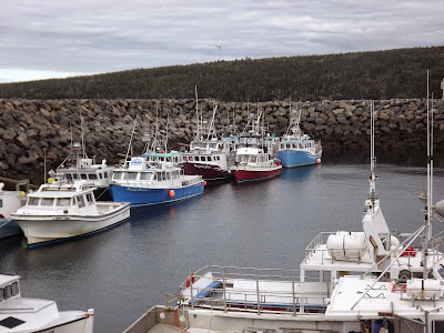
Leaving Yarmouth, I had heard of a small commercial harbor in Tiverton which was built by the government about 5 years ago but still did not appear on any charts. Perhaps that is because it is adjacent to the Ferry wharf and it is assumed that the ferry info is sufficient. I only know that few people would head here if not assured of the complete out of main channel stop over. Tiverton is the second break north in that finger of land which points toward Maine. That break hosts a very strong current with the tide changes. Imagine all that water trying to get thru this gap in a 6 hour interval. Anyway, I was able to get inside and rafted up to a fishing boat for the evening. I was also able to get some shore power to boot. You can see from the receding tide how great a tide swing goes thru this gap. I was on the dock talking to folks to make sure I would be ok in this spot and ran into a feller (Skip) who happens to be at his summer home and is from MA, a short drive from my own home. He asked if I had had lunch yet, and offered me some fresh made fish chowder. How could I refuse. It turns out that he and his wife come here every summer to spend time in the old family home where he had grown up. He migrated to the states long ago and had been making this journey for some 20 plus years.
The harbor is tranquil, but just outside those rocks is a raging flow of about 4-6 MPH. I spent a long time watching the ferry crossing the gap, marveling at how the ferry captain is able to crab his way across back and forth using different angles and approaches each time.
Firebird on the approach, crossing the currents (courtesy of Skip a soon to be made new friend)
Set up for the day tied in with the fleet. Since the lobster season is over, the boats are pretty much stationary until the next season. Most places I have been, the fishermen don't mind rafting up. Be sure to ask first.
The next morning I got up at dawn to catch a favorable Fundy tide flow to get a push for about 5 hours to Grand Manan. If I had decided to go to St John, I would have used an even better angle and got a greater push for up to 6 hours.
These two pictures of me leaving were sent to me by Skip who had befriended me the day before (thanks Skip for the pictures and delicious chowder):
The bay was as smooth as glass from the time of departure to arrival at Grand Manan. About 15 miles into the crossing I spotted what looked like rocks dead ahead, I checked my charts and my chart plotter to verify. There were no such rocks documented anywhere. Using my binoculars, I learned that these rocks were instead 3 Humpback whales sort of cruising along at a leisurely pace. I was on a course which would intercept the whales so I continued but was mindful that I didn't want to disturb them. The following pictures are my encounter. Using an electronic camera, I lost several shot opportunities because of the processing function of the camera. My old 35 MM would have snapped at will. Nevertheless what I got was pretty spectacular. Did I mention that I stopped the forward progress of Firebird and watched the whales and they didn't stop, but came right at me and that is when I thought oh-oh I'm in trouble now - they were each bigger than Firebird; when they dived under Firebird and kept on their way.
I didn't get a picture of the whales blowing out, although they did. Lets just say they could have used a breath mint.
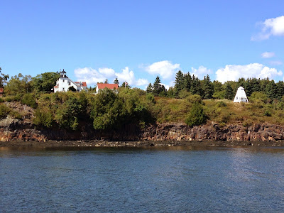
Arriving at Grand Manan, I passed an active fish weir. Later on I took a picture of this weir from Swallow Tail lighthouse.
Light keepers house
Coming out of Grand Manan I encountered this fellow, I'm told that may have been a Basing Shark.
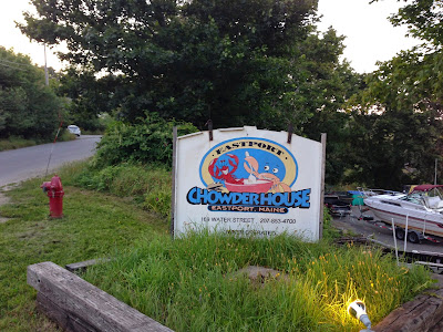
Eastport Maine; Going into Eastport allowed or required me to check in with the border/customs folks who were in the bottom floor of the post office. I hosted my quarantine flag and located the floating dock used to stop over to check in. There were 2 boats on dock and about 3 feet between their respective stern and bow. The wind was my friend this time as I maneuvered to a stop spacing both boats accordingly. Firebird drifted/was blown just as needed to the dock. I stepped off and secured the lines and headed to the Post office. Upon arrival, both officers were saying that I must have had a bow and stern thruster as no one could have put the boat into that space as precisely as I had done. Seem that they have a close circuit system that allows them to watch the entire wharf. I explained that I did indeed have a bow thruster but none was needed as the wind was my friend (not usually the case). In processing was quick and without any issues. These officers advised me that the wharf just north was where I could get fuel, this turned out to be the “Chowderhouse” dock.
One of the most pleasant things about cruising the Canadian
and Maine coasts is the great people you meet along the way. The Chowderhouse got me to meet Bob Del
PaPa. Bob is a truly magnanimous person. After fueling up, Bob offered me the
dock for the night or for as long as I needed, then invited me for a drink in
his restaurant. He introduced me to
his “Local” patrons all of whom seem to retired or active duty
Coast Guard (seems that Bob is a retired coasty). We got along great and the
evening proved to be enjoyable.
The next day Bob loaned me
his new truck to do some shopping and go to the bank to exchange my Canadian
money and coins. I was so taken by the generosity of Bob, that I wanted to stay a few more days. BTW the Sea Food Marinara at the ChowdeHouse was excellent.The goofy statue, intended to be temporary was kept as a tribute. It was refurbished after some deterioration when the town raised a special fund for that purpose. It was put back, its colors restored, for the July 4th festivities in 2005. Independence Day is a huge celebration in Eastport, where US Navy and US Coast Guard ships make a port call and conduct tours.
The setting of the wharf is extraordinarily lovely, and the statue, a heart-tugging combination of silly and sad, makes remembrance bittersweet."
I found this article on line describing the picture below: "Eastport, Maine, the nation’s easternmost city, is the home of this easternmost whimsical statue. But the silly fisherman standing on the wharf here, though perhaps less dignified and celebrated than the Fisherman’s Memorial in Gloucester, Mass., has its own poignant story to tell of tragedy and dignity.
Back in 2000, Eastport, and neighboring Lubec, were chosen as the site for the filming of a Fox television reality miniseries. It was called “Murder in Small Town X” and the scenario was a kind of whodunit contest. This 12-foot tall fiberglass cartoonish fisherman (without the pedestal), created by Jeff Poss, was a prop to represent the fictional town.
When the filming ended in 2001, the statue remained and became a curiosity, a photo-op for tourists, and, unexpectedly, a memorial.
The winner of that short-lived reality series contest was a man named Angel Juarbe, a firefighter from New York. The show’s finale aired September 4, 2001. One week later, firefighter Angel Juarbe was killed on September 11th at the World Trade Center.
Unusual donkey bench along the main street
Leaving Eastport, thru the Lubec passage heading to Bar Harbor. After rounding the Quody Point light, I ran into some rough seas and decided to make for a nearer stop. That choice was Jonesport Maine. I will just call this decision ill advised as my nickname for this area is now "Lobster buoy Hell". Having made it to the harbor at dusk, I grabbed a large mooring mid channel and spent a rocky night. Next day early in the morning, I was rousted up by the rumbling sound of multiple lobster boats engines all leaving for a days work. It was surreal, as they all were heading out from multiple points in the harbor at the same time and with their navigation lights on and the sun still to rise. I had breakfast and followed them out.
I was going to pick up a mooring at Bar harbor, I grabbed one and had lunch and sat for a while. The harbor proved to be too rolling for me so I decided to go to North East Harbor and take the free bus back to Bar Harbor for food and walking around.
Copied from Google: Thuya Garden is a gorgeous flowering garden located on a granite hillside overlooking Northeast Harbor on Mount Desert Island, Maine. It was originally designed and built in 1956 - 1961 by Charles K. Savage, a long-time resident of Northeast Harbor, along with financial support from John D. Rockefeller. The garden exhibits an English style influence with special input from Beatrix Farrand so that it will incorporate the unique character of the Maine coast. A variety of annuals and perennials line the two long sides of the garden. An open observation pavilion sits at the top of a slight incline on the north end overlooking the main garden that cascades down to a shallow reflecting pool below. Thuya Lodge was constructed from 1912 - 1916 by summer resident Joseph H. Curtis, its owner and Boston based landscape architect. The garden was constructed in an orchard also owned by Curtis. A memorial in his honor is located part way up the Asticou Terrace Trail. Thuya got its name from the abundance of white cedar (Thuya Occidentalis) located in the area.
I left Northeast Harbor and headed to Long Island just a short cruise away (approx 12 miles). The ocean was like glass the entire short run. There I visited the town of Frenchboro.
Now that is a weather vain:
I spent 2 days at Frenchboro making sure to have a Lobster diner at the Lunt's Dockside Deli and visiting the local museum.
I headed for the Blue Hills and the Kollegewidgwok Yacht Club better known as KYC. There I picked up a mooring for the night as a blow was expected overnight. The next day I walked to the Blue Hills Country Fair (about 4 miles each way uphill :-) ). The fair was fun, I had to have the sausage and pepper sandwich after smelling the aroma all afternoon.
From KYC I went to a friends house and courtesy mooring across from Castine. I enjoyed the hospitality of good friends and was able to get some fresh vegetables from their bountiful garden.
The next day I decided to head to Bucksport and visit the Penobscot Narrow Bridge and Fort Knox.
Not expecting much of the town of Bucksport, I was surprised by the town and amenities of the public wharf and the Marina. The public wharf is free but no electricity or water is available. I understand from talking to the locals that that will be corrected soon. There was a very nice river walkway and nice rest areas for picnics or out door lunches. There were restaurant close by and grocery store to replenish supplies. The marina next to the public wharf is run by the same folks that manage the public wharf. I moved over to the marina the next day as I was worried that I needed my batteries charged and water replenished.
The following pictures are of the approach Penobscott river and Fort Knox.
View from the observation room at the top of the Penobscot Narrows Bridge.
Looking down the river from the Penobscot Narrows Bridge
The town of Bucksport from the Penobscot Narrows Bridge. The factory to the left is a paper pulp facility and major employer in the area, however, I am told the factory generates more electricity that needed and sells it back to the grid for a profit. Up river is Bangor Maine.
Belfasr Harbor, Rt 1 bridge and Maine Railroad Bridge.
A dose of reality, my little boat next to some mega yachts. There is always someone with a bigger boat.
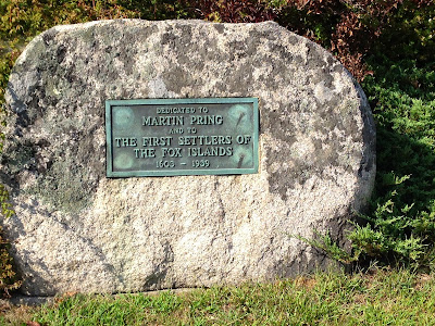
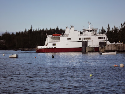
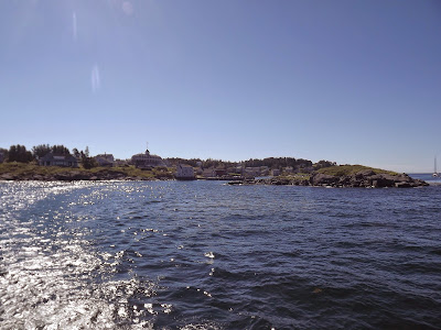
I left Belfast and headed down the coast to Vinalhaven. This a ferry that services the island daily. It creates a good wake in the mooring field whenever it arrives. The islands are called Fox islands and there is a well known thoroughfare which bisects the islands called Fox Island Thoroughfare.
Vinalhaven was a valuable sours of granite in the past, Much of their granite forms the state house columns and stars around the country and Washington DC. The wagon below is how they would transport large blocks. That wheel on the back of the wagon is 8 ft tall. The color (blue) is the official color of the granite company.
Evening on the mooring, looks like a good day tomorrow.
Monhegan Island: Taken from Wikipedia:
Monhegan is a plantation in Lincoln County, Maine, United States, about 12 nautical miles (22 km) off the mainland. The population was 75 at the 2000 census. The plantation comprises its namesake island and the uninhabited neighboring island of Manana. The island is accessible by mailboat ferry (no automobiles) from Boothbay Harbor, New Harbor and Port Clyde. It was designated a National Natural Landmark for its coastal and island flora in 1966.
The ferry dock for all passengers coming and going to the island. At low tide it can be a climb for the smaller boats.
From Monhegan Island I went to the following locations spending a night at each: Boothbay, Five Islands, Snow Island in Quohog Bay, The Gosling Islands in Casco bay, South Freeport, Newburyport, Beverly Harbor and finally to Danversport Yacht Club and Marina in Danvers Ma. where Firebird is stored for the winter.
While boating all my life, starting as a "backhander" crew for my family lobster boat, I had never spent much continuous time on a boat. This Down East Circle took 3 months in 2013 and 4 months in 2014. This adventure taught me a lot about myself and my ability to function under some challenging circumstances. The people that befriended me along the way and those that were so hospitable will long be remembered. I think that the Down East Circle was the perfect dry (wet) run for the Great Loop planned to start in 2015.


.jpg)












No comments:
Post a Comment