July 2, 2015. Anticipation of the adventure.
Well after replacing the propeller

and fixing the radar, repairing circuit breakers, painting the bottom, waxing and general repair, FIREBIRD was finally available to launch. We launched on Friday with the intent to do a shakedown cruise then provision and be off on Tuesday 30 June. Things didn’t go as planned and the weather delayed even further. Many thanks to Danversport Yacht Club Marina for their patients and understanding. Finally I loaded a large container of pretzels (which signify the start of the boating season) and I’m ready to go. For the most part I will cruise at about 8 MPH give or take a bit depending on mother nature and the tides etc.
July 2, Danversport to Onset. Cruising time: 8 hrs
FIREBIRD departed Danversport on Thursday heading to
Sandwich Marina at the head of the Cape Cod Canal. The weather was perfect and we made good time
arriving at the canal with about 1 hour of slack tide remaining. Quick look at the next day would have me
waiting until noon to take advantage of the current again so I pushed on just
clearing the canal exit as the slack was ending. I decided to make for Onset Harbor and call
it a night. Upon arriving at Onset, I
picked up a mooring ball belonging to the city.
The boat next to me was also on a city mooring and we struck up a
conversation. As people in the boating world know a conversation can lead to
other things. This time a fellow (Larry)
who was along side the moored boat offered a ride to the town dock. We continued the discussions until arrival at
the dock. I walked thru the little
“hamlet” of Onset (which is part of Wareham but don’t let the locals hear you
say that). I did some grocery shopping and stopped at Marc Anthony’s for a
sandwich. Marc Anthony’s was in full
pizza production mode and pizzas were flying out the door boxes 5-10 high, and
inside it was controlled mayhem. I paid
for the mooring $20 cash (only) and $3 dollars for a round trip on the launch.
No discounts for one way.
July 3, Onset to Block Island. Crusing time: 8 hrs
The next day I left early because of the many delays prior
to launching I was eager to put some water behind me. Also, I plan to pick up
a crew member on the 9th somewhere on the Hudson River. I had hoped
that it would be at the Federal Lock (1) in Troy. But life is what happens when you make
plans. Anyway, it was a great cruising
day and I decided to try and make Block Island.
The day went swiftly and I arrived at Block Island along with
approximately 1500 other boats.

Now I will get to test my anchor setting ability with an all chain rode. I changed the rode this year because I had only 60 feet of chain and then rope. The transition from rope to chain when leaving an anchorage had caused me trouble last season so I decided to put 140 feet of chain to eliminate the issues. Things went much as planned, but the hold was very soft so setting the anchor required amore scope than I anticipated. The first spot I selected didn’t work out so I went to another and because of the soft mud I let out extra scope, which did me well in the night.

Now I will get to test my anchor setting ability with an all chain rode. I changed the rode this year because I had only 60 feet of chain and then rope. The transition from rope to chain when leaving an anchorage had caused me trouble last season so I decided to put 140 feet of chain to eliminate the issues. Things went much as planned, but the hold was very soft so setting the anchor required amore scope than I anticipated. The first spot I selected didn’t work out so I went to another and because of the soft mud I let out extra scope, which did me well in the night.
Block Island as luck would have it was celebrating the 4th
a day early so that explained the many boats.
I ended up with front row seats for the show. It was very good and the time it ended I was
ready for some sleep.
July 4, Block Island to Oyster Bay. Cruising time 10.5 Hrs
Early in the morning I left Block Island fully intending to
end up at Port Jefferson. However as I
entered the Long Island sound I got the benefit of the incoming tide and a 2
MPH push cruising at 10-12 MPH most of the day.
I got adjacent to Port Jefferson, in such good time I decided to add
another 20-30 miles and make for Oyster Bay, as I was familiar with the harbor
and it is a good jumping off for NYC.
Upon arrival I discovered more boats gathering much the same as at Block
Island.

So I dropped anchor and cooked supper. Yes, indeed, there were fireworks and music and festival thru out the night. The fireworks were the best I have seen in many years. I was able to lie on the deck and take it all in.

So I dropped anchor and cooked supper. Yes, indeed, there were fireworks and music and festival thru out the night. The fireworks were the best I have seen in many years. I was able to lie on the deck and take it all in.
The following day I decided to stay a while and try to visit
Sagamore Hill (Teddy Roosevelt Home). I had moved Firebird to the other side of
the harbor and was in an anchor field, some 2 miles from town dock. I dingy'd to the town dock only to find
there was a loosely enforced 15 minute tie up.
So over to the Marina, and asked for permission for a longer stay, they
said OK and off I went. I hired a taxi
to go to Sagamore Hill, on the way there the driver said that the house wasn’t
open until next month, so I stopped the trip and went to the grocery store for
some provisions and went back to the boat and an afternoon of swimming off the
swim platform.

July 6, Oyster Bay to Half Moon Bay Hudson River. Cruising time: 8.5 hrs
Today was without issue, the weather was favorable and the
current on the river would also be in my favor.
I didn’t realize that the "in" tide (called Flood) creates a strong current thru Hell’s Gate. I hit as much as 6 MPH opposing currents going thru that phase of the trip. Going thru Hells Gate was not without it's rewarding sights:

EL GALEON tall ship (replica). I understand that they take tours on this ship as far as Florida. If you really want to feel like a pirate or Columbus this is the ship for you.


It was not until I saw Lady Liberty that the opposing current abated.

Once I turned the corner, I got that 1-2 MPH push up river all the way to Croyton-on Hudson (Half Moon Bay). I anchored off the State Park in 12 feet of water and settled down for a peaceful night.
I didn’t realize that the "in" tide (called Flood) creates a strong current thru Hell’s Gate. I hit as much as 6 MPH opposing currents going thru that phase of the trip. Going thru Hells Gate was not without it's rewarding sights:


It was not until I saw Lady Liberty that the opposing current abated.

Once I turned the corner, I got that 1-2 MPH push up river all the way to Croyton-on Hudson (Half Moon Bay). I anchored off the State Park in 12 feet of water and settled down for a peaceful night.
July 8, Croton-on-Hudson to Kingston. Crusing time: 7.2 hrs
The trip to Kingston was easy and enjoyable I left at noon
to catch the favorable current and cruise at lower RPM, but higher speed. There was a small rain shower, lasting about 5 minutes but for the most part
an easy cruise. I went into Rondout Creek and went in about 2 miles to a quiet
anchorage. There I would wait another
day for a crew member to join me. I
decided to move from the anchorage to the Rondout Marina for my last day on the
river to take advantage of the electricity and swimming pool while I waited for
my company. When my crew arrived, we
shared the pool and then went to the “Ship to Shore” restaurant for evening
meal, mine was rack of lamb which was delicious. Staying at Kingston would give
me a final Hudson River run of approximately 64 miles to Waterford, where I
expect to stay on the city wall for the night. My friend Randy would join me at Kingston and would cruise with me for the next 2 weeks. We had to go over a few things like duties and where things were stowed etc.


Having lowered the mast that morning Randy and I shoved off
for an uneventful ride to Waterford. When we got to Albany and Lock 1, we
encountered the only excitement for the day which was 3 boats with drunk women
showing their “credentials”.
Unfortunately Randy and I were so busy with negotiating Firebird thru
the water turbulence and into Lock 1 that we completely missed the show. The Lock Master provided us with the show
report and we figured that was the reason for long delay encountered with the
opening.
July 11, Waterford to Amsterdam NY. Cruising time: 8.3 hrs
First Erie Canal locks as we cruised to Amsterdam. where we would tie up to a city wall and spend the night.

After arriving at Amsterdam, we went to a BBQ, Randy really liked the wings.


First Erie Canal locks as we cruised to Amsterdam. where we would tie up to a city wall and spend the night.


July 12, Amsterdam to Lock 17 Little Falls NY. Cruising time: 7.3 hrs
July 13, Little Falls to Rome NY.
July 14, Rome to Sylvan Beach, NY.

July 15, Sylvan Beach to Baldwinsville NY.
July 16, Baldwinsville to Seneca Falls NY.
Went past this boat, named the African Queen complete with rust and general weathered look made on purpose:

July 1, Seneca Falls to Watkins Glen NY.
From Seneca Falls to Lake Seneca we encountered about a 1
MPH current against us. In addition we
went under several of the lowest bridges and gates so far. One railroad bridge just had approximately 6
inches of clearance.
Just leaving Seneca Falls heading west we spotted these statues and works of art, this first picture is made up of huge pump housings. The significance is the pumps where manufactured in Seneca Falls.

Upon my return to Seneca Falls I asked the local folks about these statues and having difficulty describing them, a local said "you mean the statues that look like they are taking a leak"? Turns out they are dedicated to the Italian workers who dug the canal. When viewed from land we would have seen shovels.

On the way we passed the remains of the original canal aqueduct which was used to move canal boats.


Built by Italian laborers, so of reminds me of the Roman aqueducts.


We had to cruise the entire length of the lake to get to Watkins Glen. The wind picked up and there were white caps and spray all the way. After arriving at the harbor, the job to get in-between pylons and the docks with a stiff wind proved to be a challenge, but, we made it.

We spent the remainder of the day walking the Gorge and town. The following are pictures from the Gorge:
Just leaving Seneca Falls heading west we spotted these statues and works of art, this first picture is made up of huge pump housings. The significance is the pumps where manufactured in Seneca Falls.


We had to cruise the entire length of the lake to get to Watkins Glen. The wind picked up and there were white caps and spray all the way. After arriving at the harbor, the job to get in-between pylons and the docks with a stiff wind proved to be a challenge, but, we made it.

We spent the remainder of the day walking the Gorge and town. The following are pictures from the Gorge:


Randy enjoying the cool view.


We had diner at a BBQ place along the main
street, which was above average.
As always I am amused by signs I see along the way, can you guess what Randy's wife name is?

That evening we listened to various bands on the waterfront and settled in on Firebird to the tunes of a Jazz/Blues band at the top of our dock.
As always I am amused by signs I see along the way, can you guess what Randy's wife name is?

That evening we listened to various bands on the waterfront and settled in on Firebird to the tunes of a Jazz/Blues band at the top of our dock.
July 18-19, Watkins Glen to Seneca Falls. Crusing time 5.3 hrs
On our return
toward Oswego Canal, and because of the favorable impression made on us on the
way east we felt that no better place to stop was Seneca falls. The restaurant choices and tie up is
excellent. On the way west, we noted
that there was a who done it play being performed tonight so we got tickets and
walked to the High School (Academy) where it being performed. While the community players were certainly
enthusiastic, the screenplay was a little wacky. On our way back to the boat Randy and I had a
good chuckle about it. It was a good diversion for us.

July 20, Seneca Falls to Baldwinsville. Crusing time: 5.5 hrs


July 21, Baldwinsville to Winter Harbor for fuel and repairs. Cruising time: 3.6 hrs
July 25, Winter Harbor to Oswego. Cruising time: 6.3 hrs
I arrived at Oswego after several days in Winter Harbor for repairs. I had to have my alternator rebuilt and it proved to be an expensive proposition. Never the less, the trip thru several locks on the Oswego canal and arriving between Lock 7 and 8 proved to easy and without incident. I cruised to the start of Lock 8 looking for a free wall with electric service but there was none, so in the canal in a narrow section, Firebird came about and went back closer to the Lock 7 exit to get a smooth portion of the wall for tie up over the night. As I suspected all the spaced below Lock 8 were taken for the "drunken Harbor fest taking place and the "Fireworks display" that evening. Several boaters were already tied up and they came over to help with lines and comment on how nice Firebird looked. Lots of envious folks admiring the "bird".


Of course Mr Wilson had to get into the act.


So far I have traveled 51.1 miles. I stopped for the night tying to the wall with some other boats all traveling in the same direction. Right after I stopped and got things stowed there was a strong rainstorm which dropped a lot of water in a short time. Good decision to stop.
Aug 3, Buckhorn to Kirkfield Lift Lock 36.
Mackinaw Island:
Marina approach with the white fort in the background.

Each night the fort would play the national anthem and then at around 10 they would play TAPS.


Believe it or not but this is 10 feet of water beside Firebird. Clear as can be.


The Grand Hotel: The largest employer on the island having as many as 600 employees during the tourist season. Interesting as well is that sign ahead signifies that you must be a guest of the hotel or pay 10 dollars to go beyond that point. The purpose is to reduce tourist traffic. It worked on me.

 After Mackinac there were a series of stops along the western coast of Michigan leading to Chicago.
Mackinac Island to St Ignace Cruising Time: 3 Hrs
Petoskey MI to Frankfort MI Cruising Time: 10 Hrs
Frankfort MI to Ludington MI, Cruising Time: 6.5 Hrs
Ludington MI to Muskegon MI, Cruising Time: 8.5 Hrs
Muskegon MI to Grand Haven MI, Cruising Time: 4.5 Hrs
The following photos are of the stops along the western coast of Michigan:
Grand Haven


Saugatuck,


28 Aug 2015, South Haven to Chicago; Cruising time 13.5 Hrs.
The following are a series of pictures that were taken in the windy city:
Chicago Skyline:


Heading for the "Play Pen"

Next nearest boat anchored in the "Play Pen"


There is a stage in the center of this picture. While there we watched the rehearsal of a dance presentation to be given that evening.

This art object is called the BEAN, can you guess why? Highly polished by elves at night, people come from all over to put their fingers on it.

Can you see me in the reflections?

NOW? I couldn't resist putting my hands on the bean. I might add that while walking up to it to pose for the picture, I almost bumped my noggin as the shape and slope are disorientating.

Proof that I was there:

Can you say Presidential Suite?

Boston got rid of it's elevated roads and trains.

Do they have any guests?

This is a parking garage, design was inspired by a tree

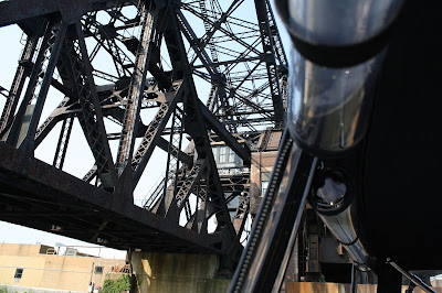
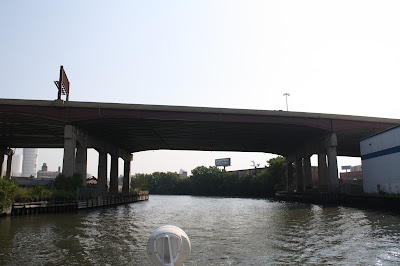
One of the many city bridges in Chicago. When we leave we will be motoring under 36 of the 40 such bridges. We took a boat tour of the river system so that we would know what we were passing thru, under or by. The following are some pictures of what I saw:


 Our boat tour


The Boat Captain


When it rains you share an umbrella.

Went into Bloomingdales to observe their stain glass windows.


Taken from the 95th floor.

A view down the coast line from the Natural History Museum

Inside the museum. May I introduce SUE, named after its discoverer.


Park statue in Chicago, cannot guess who it is suppose to be.

Went out on the Navy Pier and listened to a Puerto Rican band.


This is an indoor pool in the American International Hotel where Ester Williams and Johnny Weissmuller (Tarzan) swam.


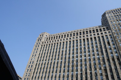
Interesting story about this statue a top the old Montgomery Ward Building, which was called "Spirit of Progress", but in the closing years of Montgomery Ward they were having so many discount sales it was called "Spirit of Perpetual Discounts".


Views from McCormick Bridgehouse Museum (next 4 pictures)


Leaving Chicago thru the canal system to Illinois River to Joilet MO Sept 2015 Cruising Time: 9.1 Hrs


What's up man?

Mike took most of these pictures as we passed under 36 of the 40 bridges on this river

Can you say Presidential Suite?


AS we get further away from the center of the city, it becomes less tidy.

Cruising the Illinois river and canal system got us use to the barges and TOWs. TOWs are the official designation of the tug and barge combinations. While the tug typically pushes the barges the name is a little misleading. I suspect that the term came about when the barges were towed along the canals by oxen and mules and just remained. Anyone got a better explanation please let me know. The first TOWs that we encountered were small and our actual first panic encounter was when we were heading south and a TOW heading our way requested that we continue and pass on the 2 whistle. Confusion reigned for our 3 boats and the tug operator finally blew 5 whistles which signifies all F*** Up and get out of the way. We tucked into a break of moored barges until he passed. Lesson learned, make sure you have complete communication and agreement with the TOW as they would just swallow us up on a mistake.


We cruised the river heading south with a 1-2 mile per hour push. We stopped in Joilett at a free wall and spent the night. It was a free stop but the community has failed to capitalize on their resource by promoting the wharf and provide easy access to the city. I'm sure we would have stayed another day if there was any effort by the community to encourage that philosophy. Anyway we headed south the next day and made a stop in Peoria. There was a free dock, with farmers market, Blues festival, restaurants and museums. Since this is Caterpillar country, we went to the CAT Museum. Some of the equipment is humongous.

This truck is delivered by 3 railroad cars and assembled on site.


After doing the museum, we walked around town an I spotted this sign and you know the rest.

Peoria also has a Natural History museum which was really interesting, in addition they had a large screen theater which presented a documentary in 3 D to portray the Normandy landing of WW II, it was very well done.

Mike taking a rest and cooling off.
River boat tours coursing the river at night.


6 September we left Peoria traveling down river with the current giving us a good push sometimes as much as 4 MPH, but usually about 2 MPH. This saved a lot of fuel. Our next stop was Havanna about 5 hours cruise. The marina was small and very shallow, when a TOW went by going up river its force actually pulled water from the marina and the boats would go down accordingly. Walked around town, not much happening on a Sunday. This is the 3rd oldest functioning water tower in Illinois. Impressed?

Main street on Sunday afternoon. Totally deserted, I think that car took a wrong turn.

Interesting Civil War memorial.

Mike took this picture as we cruised the Illinois river, I don't have a clue as to the bird's identity.

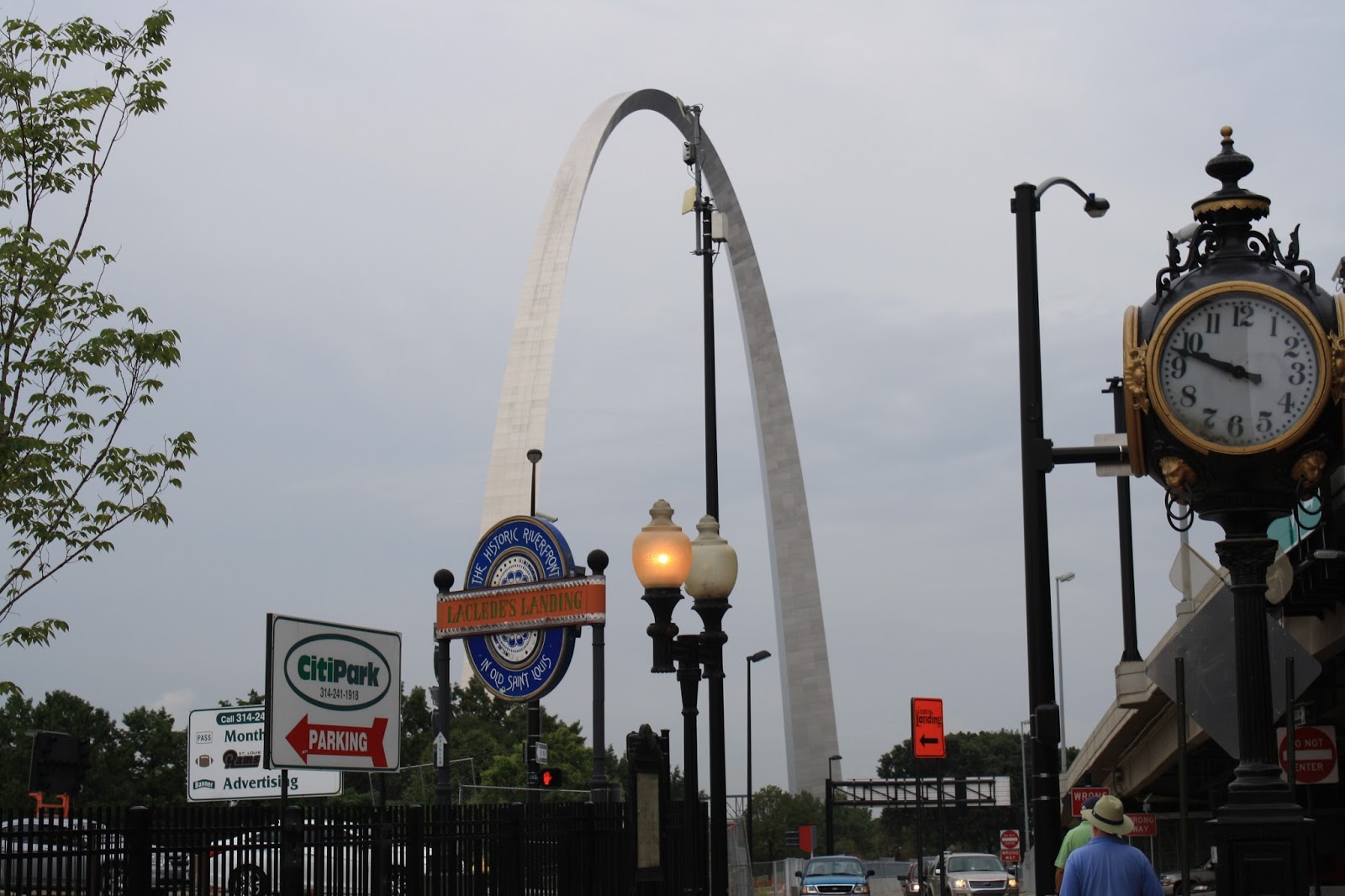
After Havana we cruised for 10 hours to get to suitable anchorage at Wing Island. From there we cruised another 14 hours to get to Port St Charles Marina where we will spend 2 days. They have a loaner car which we are able to drive to St Louis. The following are pictures taken in that city.


Vies from the top of the ARCH. Bush stadium.


From the ARCH we traveled to the Anheuser-Bush brewery and took the tour:


 The stables:
 The brewing rooms
The aging vats are located in this room, 3 stories high with vats on all levels, temperature controlled. Mr Bush bought the chandelier at the 1893 Chicago World Fair

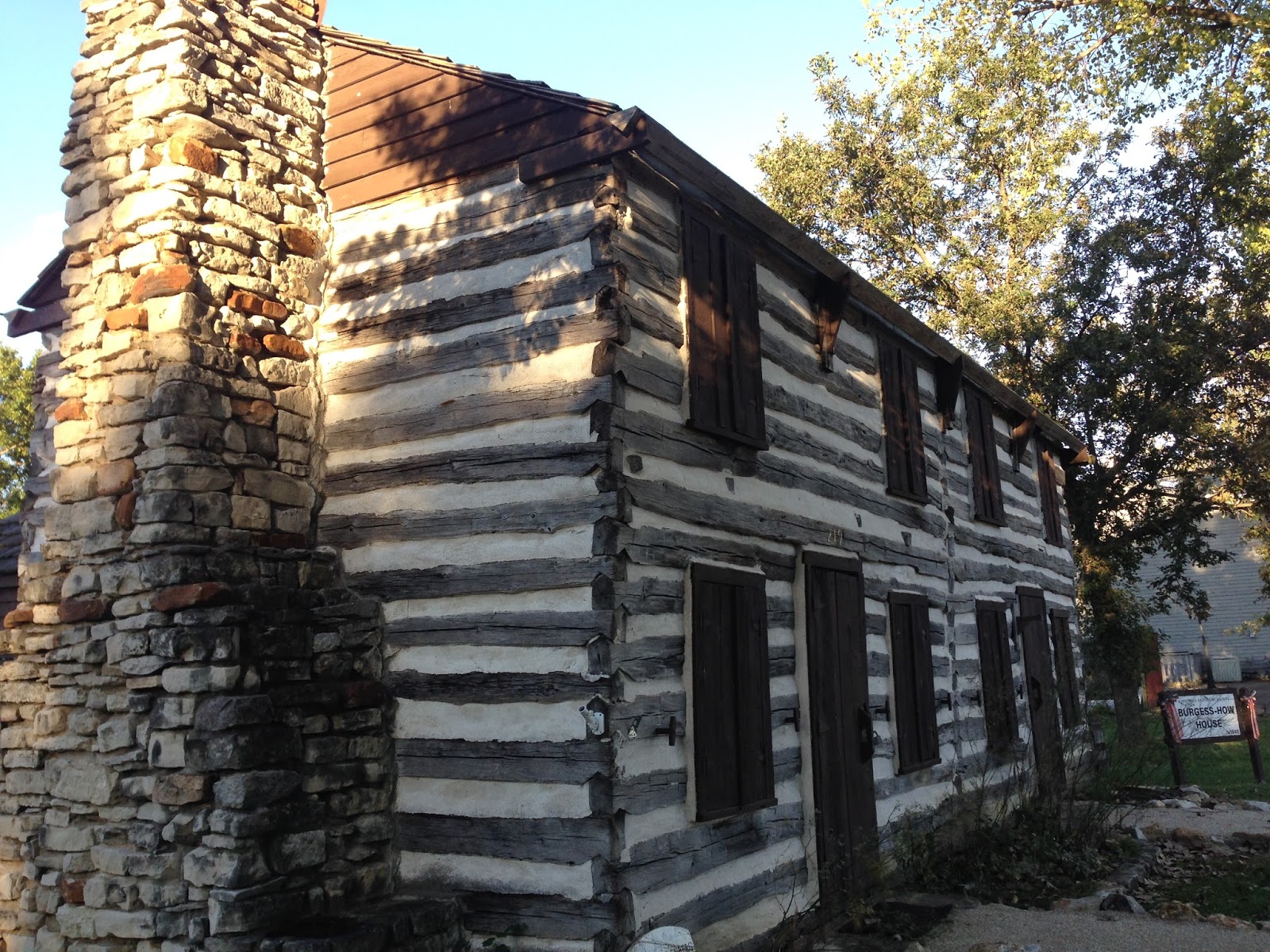
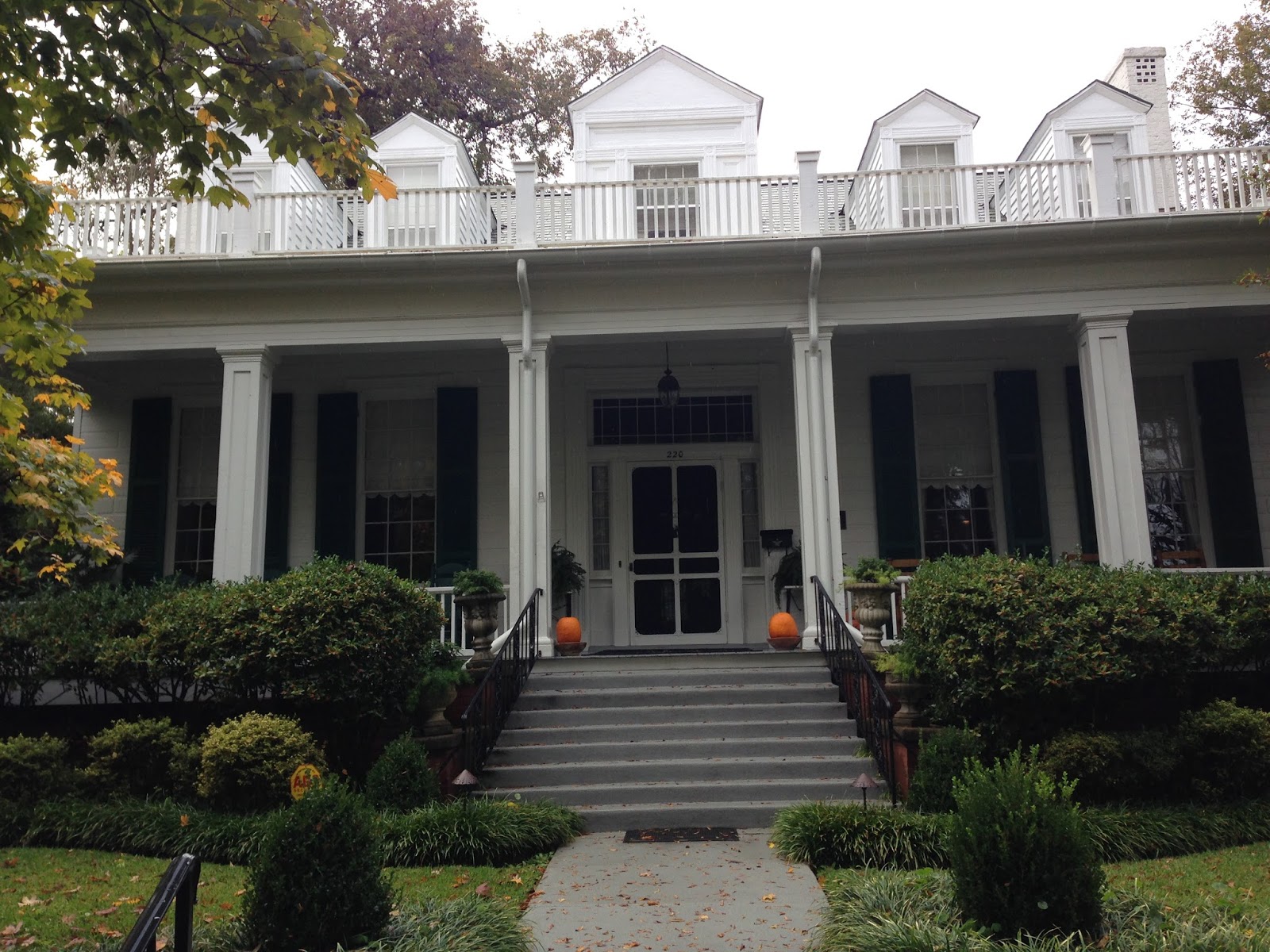
From Port St Charles we wend down the Mississippi River to a series of barges linked together to serve as a tie up and fuel stop called Hoppies. It was at a town called Kimmswick MO, which happens to be the second oldest town in MO. Bush of the beer fame had riding stables here. There were several log cabins in the town all in good shape and being used, which is unusual for a town this small.

Our next major stop was in Green Turtle Bay Marina where we rented a car which allowed us to drive to Nashville. Because we started out late we were there at evening, so the pictures are with available light.

The original Grand Old Opera House;

Thomas Ryman statue, famous Stern Wheeler captain who donated the money to build the Opera House.


At Green Turtle Bay we dined at a local restaurant (Patties)known for their 2 inch pork chop diner. They had grounds around the place with lots of unusual bird houses.

Kinda reminds me of Petticoat Junction or Green Acres.

This is the city flood wall at Paducah Kentucky. When floods on the Ohio river are immanent they close the flood gates which access the river. There are mural paintings all along the wall which depict the early history of the region. Quite impressive.


 Shiloh


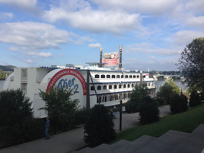
Chattanooga is a great city to visit. I was able to get a ride to the Incline railroad which ascends Lookout mountain. These pictures are from the mountain and the river.


Side wheeler used for tourism.

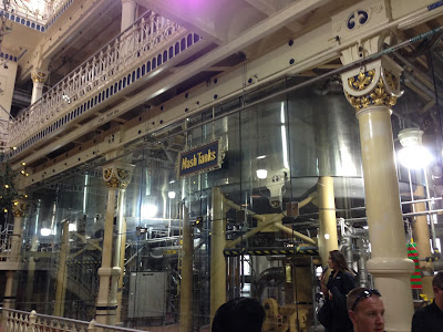
The last day in Chattanooga I went to the Aquarium complex which comprises of 4 buildings and surrounding grounds. The Aquarium is divided into a fresh water river system and a salt water building the third building houses an IMAX theater which was showing the Monarch butterfly, Humpback Whales or the pictures from the Hubble spacecraft. I saw the Monarch butterfly show which was also in 3D. Very interesting. Next to the river system aquarium that I found to be more interesting as I have been to many salt water aquariums in the past. Typical display in the fresh water system and one which I expect to see on the journey south.

These pictures were of salt water jellyfish with special lights.


After the rendezvous is completed there is a tradition that the musically capable boaters hold a music session.


Reliefs on the Corinth Museum wall entrance:

Since the battle of Shiloh and Corinth were for control of the crossroads of the southern railroads I thought a picture of that crossroad was fitting. Although the rails have been updated, this is what the battles were all about.


Memorial Day was established following the practice of Confederation Decoration Day in Columbus. Some credit Columbus, MS and 12 Gables for its foundation.


Downtown plaza

Interesting balcony downtown.Reminds me of what I'd see in old New Orleans.

This house is Columbus' information center. It also was the home of Tennessee Williams

The Waverly Home and estate. Interestingly this place was abandoned for 50 years before being purchased by the Snow family from Pennsylvania in 1962. They have gone about restoring this stately mansion to it's original state. In touring this home we were fascinated by the fact that it was never vandalized, and original windows, mirrors light fixtures etc were left intact. The cupola was used as a lookout vantage for General Nathan Forrest during his recuperation from wounds while staying there as a guest of the Young Family (original builders of the estate).

Entrance walkway to the Waverly.


At the lock there is a period building which copied the antebellum homes that you saw earlier. The cupola from the Waverly among other design features were used as models for this building. Called the Bevill Information Center it was named after Senator Bevill who was instrumental in securing funding for the center. A lot of the pieces are from the correct period while others are replicas.

Note the mirror.


This mirror is called the chaperon mirror can you guess why?


The map shows the Tenn-Tom waterways. Firebird is traveling down the far left route.


The crew of Firebird and Moni Jean visited the Bevill Lock Control Tower and were able to view the process of locking thru a TOW as seen in the following pictures.


Oct 29/15: Belville Lock to Sumter Recreation Area (MM272) Cruising Time: 5.8 Hrs
Anchor out for a good nights sleep.
Oct 30/15: Sumter Rec Area to Rattlesnake Cove, Cruising time: 6.3 Hrs
Anchor out for a good nights sleep.
Oct 31/15: Rattlesnake Cove to Demopolis, Cruising Time: 1.8 hrs
This stop included refueling picking up mail and getting a repair package for my outboard motor. I found that cruising to a marina as the next stop if you arrive early in the morning you have te entire day to get aquainted with the area and if a loaner car is available, then you are not in competition with late arrivals. That is my explanation for anchoring out the night prior and such a short run to the marina. When I travel all day and arrive at a marina I'm usually too tired to do anything so I end up waiting another day.
Nov 3/15: Demopilis to Bashi Creek, Cruising Time: 10.4 Hrs
This is a picture of the chart plotter which shows how the river switches along the way south. In some instances we actually end up heading north to get along the waterway. The one icon with the 1/2 mile line showing heading is Firebird. Those green triangles you see are other boats or TOWs with Automatic Information System (AIS) and their direction. AIS gives me a chance to view the vessels and their speed, names and other information that helps me on the journey.Those numbers are mile markers (MM) the 82 means I am 82 miles from Mobile which is MM 0.

Nov 6 Tensaw River to Mobile AL (Dog River): 8.1 hrs
Entering Mobile Bay and harbor.This section is the industrial portion of the BAY.


New trimaran warships being readied for delivery to the Navy.


 Dry docks


Container loading and unloading cranes.

Nov 7/15, Side Trip to New Orleans:
We drove to New Orleans for a little side trip while Firebird is attended to for some minor maintenance.


Typical frontage of homes and hotels within the old section of New Orleans.


Statues to honor some of the city's famous musicians.


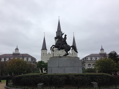
Andrew Jackson statue

Andrew Jackson statue with cathedral in background.

This is a statue to honor the founder of the city.

As you probably know, I like quirky signs, this one was spotted at the home of the local minister's home.

In the old sections most streets have identification such as below. New Orleans was governed in succession as French, Spanish, French, Confederate, and USA.
 This is one of the many cemeteries in NO.


This was the mint which printed the ten dollar bill with the word DIX (French for 10) on the rear. This became the origin of the use of the term "Dixie".


The locals call this statue "Joanie on a pony".


New Orleans was named after Joan of Orleans.
 Interesting note, the houses and shops were built side by side with gardens and courtyards thru to the rear of the buildings. With pending danger, the children and women would be sent to those courtyards as the front of the buildings were fortified for defense. An unintended consequence of this approach was that when Hurricanes hit because of the buildings arrangement they eliminate the wind tunnels and the buildings are better suited to ward off damage.

The start of Frenchmen Street, where Jazz and Blues are played nightly in several clubs. Unlike Bourbon street, there is a more civilized atmosphere on Frenchmen.

Having spent several exciting days in New Orleans I for one was not ready to leave but the water ways were calling. On the way out of the city, we took a ride past the Superdome:


After leaving New Orleans I returned to the Dog River Boat Yard fully expecting to have the Propeller inspected, the oil leak fixed and the starting system issues resolved. Well that is not what I received. The boat had not been pulled and inspected and the starter system issues were inconclusive. After some mild "conversations" with management. I got the boat pulled for an inspection which was negative (that is good).
12 Nov/15: Dog River Marina Mobile AL to Ingram Bayou, Cruising Time: 7 hrs
The next day with bad weather coming in I decided to shove off for the next destination. The trawler "Panda Bear" would accompany us across Mobile Bay. That night we anchored in Ingrams Bayou having met up with another "Looper" Moni Jean. Unfortunately Panda Bear was a tad slow to reach the anchorage so we did not see them until the next day.
This is a picture of a friendly pelican who jumped into the water and got a morning meal as I snapped the photos. Very quick breakfast.


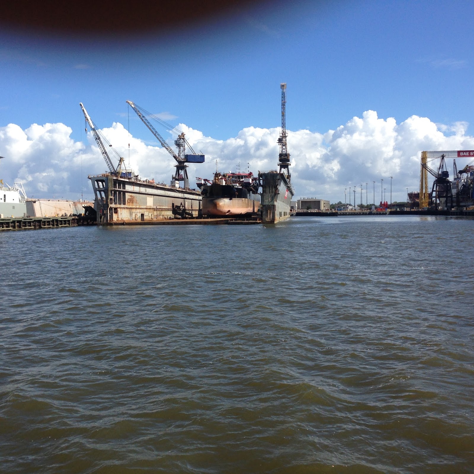
I tried to start the motor at first light but it wouldn't turn over. So the problem with the starter still exists. Fortunately I was able to turn on my generator and after a short while able to start the motor. I was going to anchor out another night before cruising into Pensacola but the starter issue changed my mind. So next stop was Pensacola. On the way I called a friend and got a mechanic to meet Firebird upon arrival at the Pensacola Navy Base Marina called Bayou Grande .
13 Nov/15: Ingrams Bayou to Pensacola NAS Cruising time: 4.1 Hrs
Traveling the ICWW i past many marinas with lots of different boats in storage or on docks but not one like this (arrrr):

Welcoming sign going into Florida:

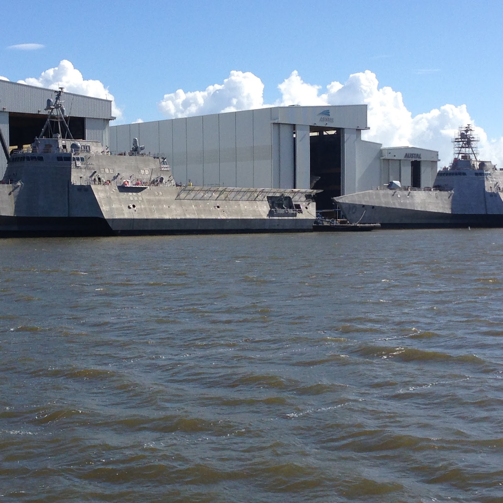
As I cruised to the Pensacola Navy Marina and I passed this Trimarand warship at dock. There was security near the ship to make sure I didn't get too close.This is a new generation of warship design.

I stayed at Pensacola Navy Base marina for a few days to get my oil leak fixed and my starting problem addressed. The base is home to the Navy Blue Angles and the Navy Flight Museum. The following are pictures of the museum and contents.

These pictures are of the bar which was at Subic Bay Philippines which was dismantled and reconstructed at the museum as it was in its original enviroment after the Navy left that base.


 Older Navy trainer

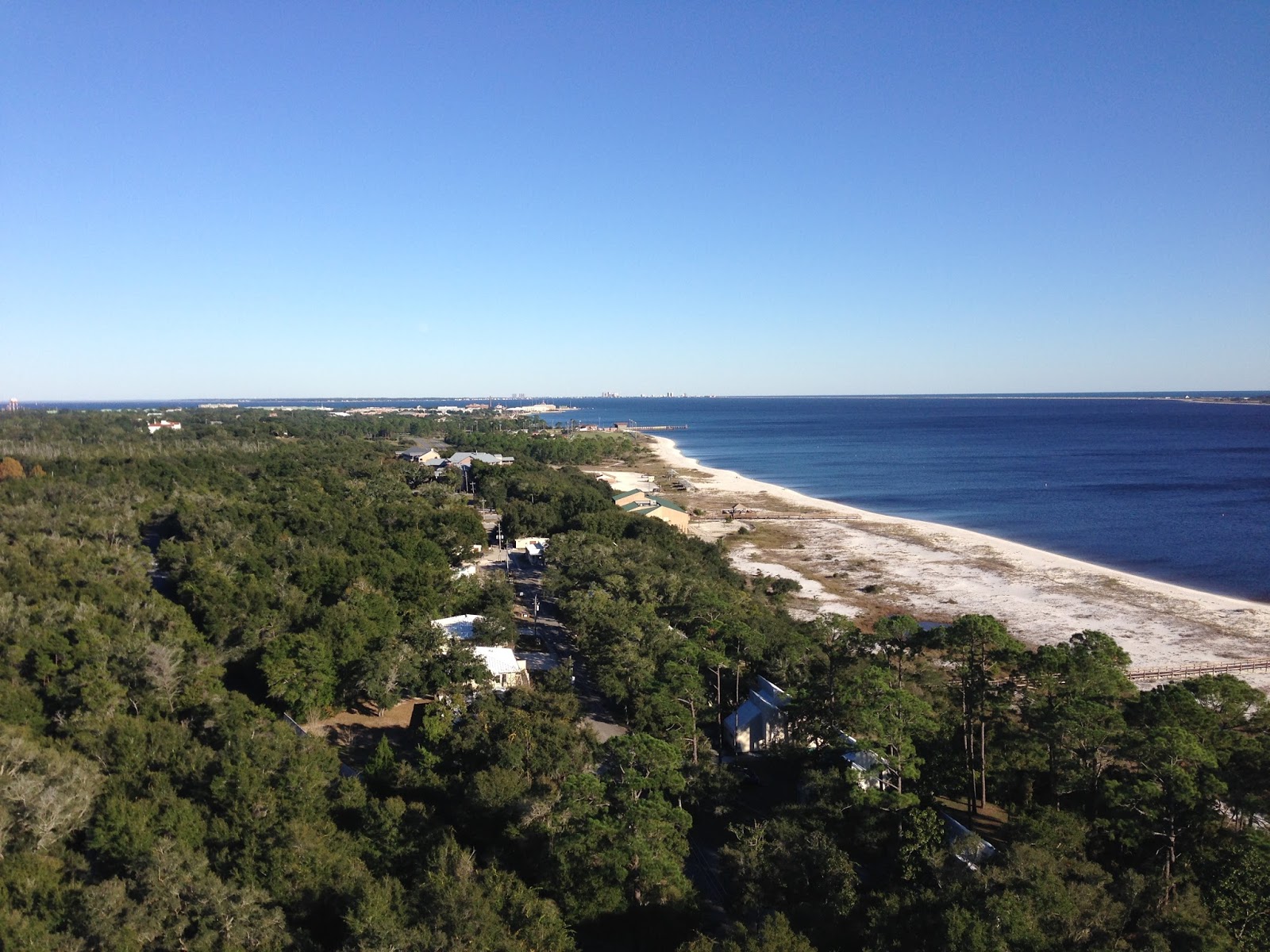
 Lighthouse on the base which has great views of the gulf and base.


 Looking back at the base and Blue Angle Hanger facility.
 Pensacola waterfront and monument to founding Spanish leaderTristán de Luna. Taken from Wikipedia: "In 1559, Tristán de Luna y Arellano landed with over 1,400 people on 11 ships from VeraCruz, Mexico.The expedition was to establish an outpost, called Ochuse by de Luna, as a base for Spanish efforts to colonize Santa Elena (present-day Parris Island, South Carolina.) But, the colony was decimated by a hurricane on September 19, 1559,which killed hundreds, sank five ships, grounded a caravel, and ruined supplies. The 1,000 survivors divided to relocate the settlement, but due to famine and attacks by the Pensacola, they abandoned their effort in 1561. About 240 people sailed to Santa Elena, but another storm hit there. Survivors abandoned the settlement and sailed to Cuba. The remaining 50 at Pensacola were taken back to Mexico. The Viceroy's advisers concluded northwest Florida was too dangerous to settle, a view which stood for 135 years."


 Unusual tower on this ship. I wasn't able to find out its purpose.

23 Nov/15: Pensacola to Ft Walton Beach (Free Dock) 6.9 hrs
Next stop was Fort Walton Beach public dock. Since it was a free dock and close to some friends I decided to stop and spend the night to catch up. Tom and Mike:

Fort Walton Beach public dock area


25 Nov/15: Destin to Goose Bayou: 8.4 hrs


26 Nov/15: Goose Bayou to Panama City: 2 hrs


The next several pictures are the works of Edgardo Carmona which were promptly displayed around the city. The are here from Jan thru March. The Chamber of Commerce provided maps of the city and the sculptures.
Cadencia

 Mambeo


Negacion a Baco


Al Filo


Melomano

El vendedor de raspao


 Utopia


The Ford Edison estate is a long walk from the marina or a short Trolly ride and houses the winter homes of Thomas Edison and his neighbor Henry Ford. Edison used this location to find a suitable substitute plant for latex used in making rubber.The need was established during WW1 when the source of rubber was deemed a strategic material and transporting from the tropics to USA was a logistical problem.
Thomas Edison
 Henry Ford


 Edison winter home.
 Mrs Edison, she donated the estate to the City of Fort Myers.
 Ford, Edison and Firestone strong friends who shared hunting, fishing and camping together. Firestone and Ford were frequent visitors to Edison's home and collaborators on the quest for a new source of latex. Just prior to WW2 Firestone developed petroleum based synthetic rubber
 Ding Darling Wildlife reserve. Named after Jay Norwood Darling who was responsible for creating the reserve and was what I would call a conservationist in the mold of Teddy Roosevelt. Ding was his nickname and an pulitzer prime winner for this cartoons. He was responsible for establishing the Duck Stamp which is used to fund wildlife conservation and land purchases thru out the USA.
 Sanibel lighthouse

 As is the case most week ends, there is a function in Ft Myers. During February there was a celebration of Lights to honor Edison. The parade was at night and consisted of 18 bands and countless floats. One of the floats had youngsters who were part of a junior court . I spotted this princess at the ice cream shop waiting for her treat, but obviously tired out from a long day.
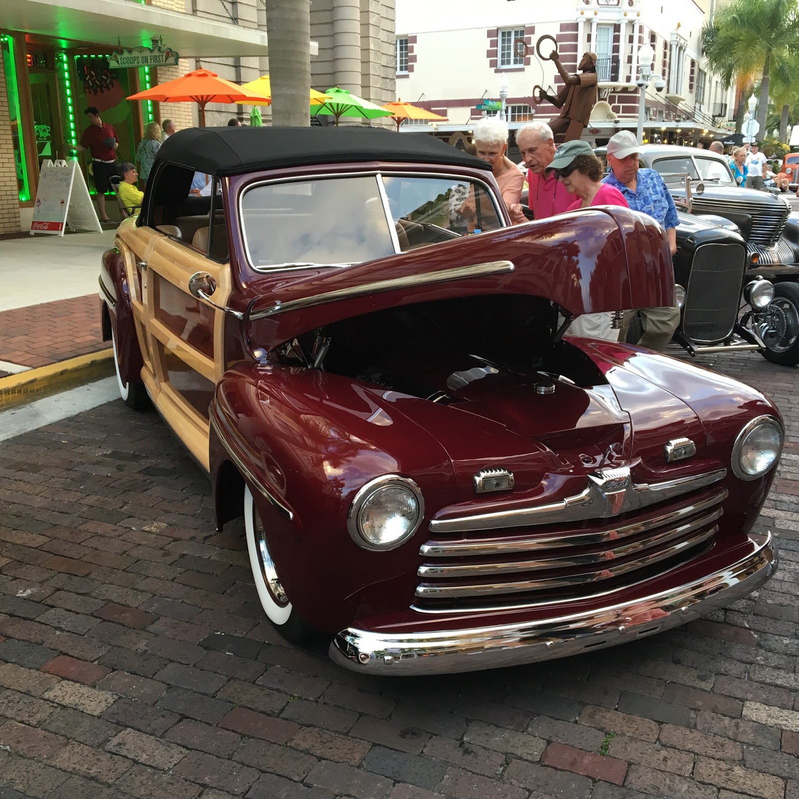
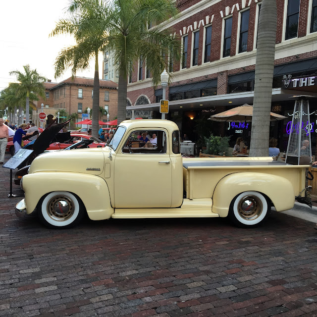
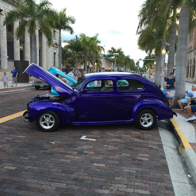
 Ft Myers holds many events and several car shows free to the public. Have you ever heard of a Graham automobile?
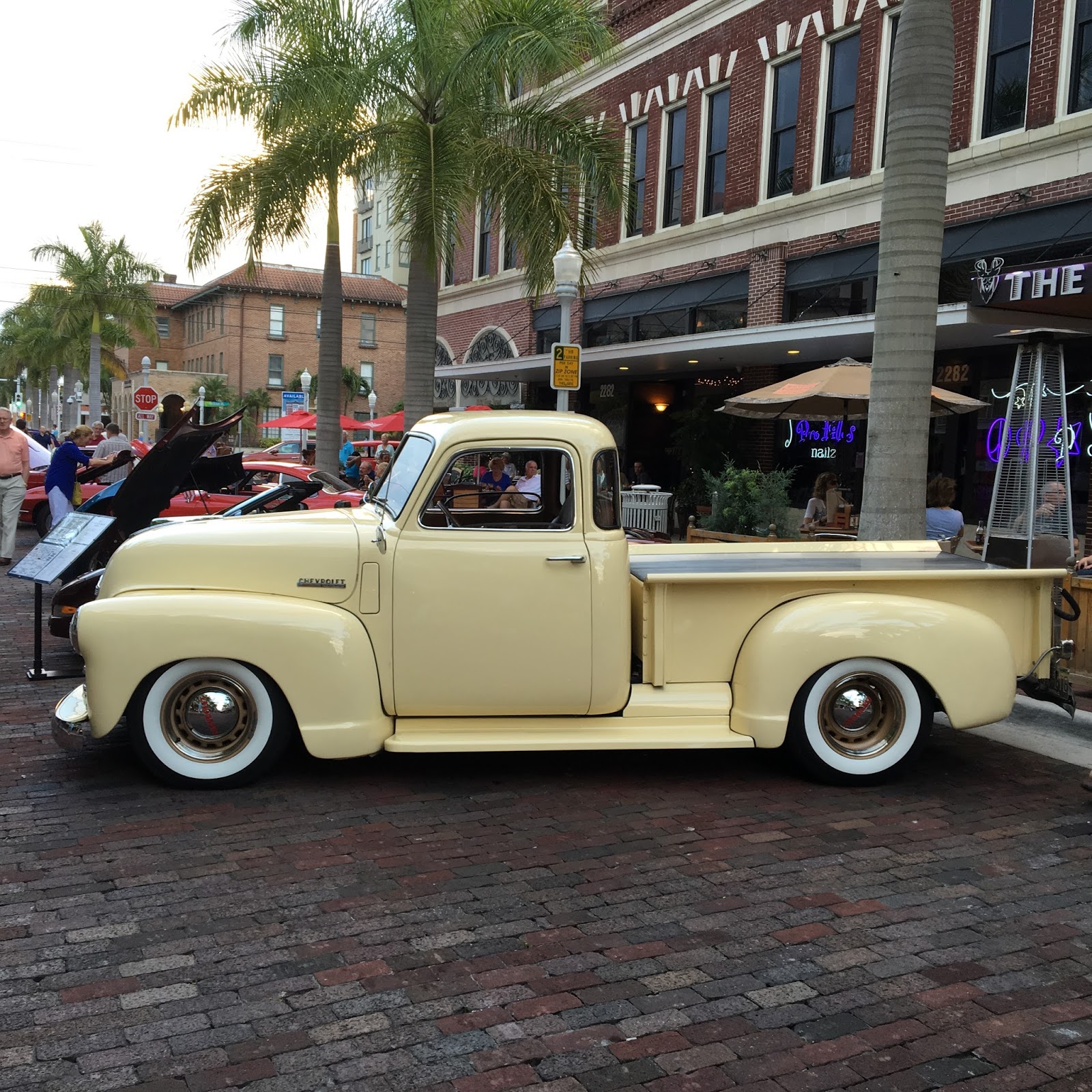
 Neat color.


 A typical mangrove root system. You can see how this tree is so valuable to stabilize the lowland Florida coastline

 Power Plant and the source of the warm water that will keep the Manatees comfortable. There is a under road tunnel system which brings the coolant water to the power plant and the discharged hot water back. This canal is cement lined so there is no food source for the Manatees which means that they will have to leave the warm waters to get food. Since their digestive systems take about 7 days, that is about how long they can wait until forced to move.


 The water is an extreme dark chocolate color caused by the water discharge from Lake Okeechobee. The unusually large amount of rain in Dec and Jan has caused the high discharge from the lake and in turn creating an ecological mess on the Caloosahatchee River and tributaries.
 A protest encounter warning me to leave so the inhabitants can get back to living without human interference.

The spring training season has started and I wanted to see the stadium and some of the new members of the Red Sox. The stadium is very modern and it looks like it is very profitable. My visit was on St Patricks day and the Sox were in their green shirt uniforms. The next few shots are the stadium and one special player.

A modern Green Monster

Batter up: "Big Pappy"

PoP up!

Infield
 Outfield

Saint Patricks day celebration in downtown Ft Myers didn't involve a parade that we see at most big cities. Instead, the City closed off the main city and had 6 bands playing in different sections of the closed off area. It was very effective for the evening entertainment.
 Irish pups.


I choose to
travel back to Winter Harbor because I read they were very good repair facility
and I wanted to refill my tanks before I went across to Canada. I was noticing that not enough voltage was
getting to the Auto Pilot so I wanted them to check it out. It turns out that the alternator was bad.
Three days later, I had my alternator rebuilt and I was on my way considerably
poorer.
July 25, Winter Harbor to Oswego. Cruising time: 6.3 hrs
I arrived at Oswego after several days in Winter Harbor for repairs. I had to have my alternator rebuilt and it proved to be an expensive proposition. Never the less, the trip thru several locks on the Oswego canal and arriving between Lock 7 and 8 proved to easy and without incident. I cruised to the start of Lock 8 looking for a free wall with electric service but there was none, so in the canal in a narrow section, Firebird came about and went back closer to the Lock 7 exit to get a smooth portion of the wall for tie up over the night. As I suspected all the spaced below Lock 8 were taken for the "drunken Harbor fest taking place and the "Fireworks display" that evening. Several boaters were already tied up and they came over to help with lines and comment on how nice Firebird looked. Lots of envious folks admiring the "bird".
July 26, Oswego to Lake Ontario.
Today started out to be a journey to Kingston CD. However as I left the harbor at Oswego I
could see a fog bank out in the distant horizon. I figured that it would burn off as the sun
reached high. I traveled about 4 miles
and hit the bank, I continued another 4 miles but the air kept getting colder
and the sun was not doing its job.
Normally this wouldn’t bother me and I would press on because I would
have the assistance of my radar.
However, the boat mast was in the down position to allow clearance in
the canals and under the “LOW Bridges”.
Therefore, it was not functional for the fog. I decided to turn around and spend the day in
Oswego and try again tomorrow. I
returned to the harbor and tied to the lower wall thinking it was free just as
the upper wall was. Wrong. Soon two
administrators arrived to collect their fee for the tie up. Normally the fee wouldn’t bother me, however
there was no water, facilities or electricity offered. I made the decision to
go back thru the lock O-8 and tie up above the harbor. It was free and offered the same amenities so
I returned to the same spot I left this morning. There were two other trawlers tied up in
front of me, “Happy Clam” and “7/10th”. I spoke to them and we all agreed to leave
tomorrow and have available one of the boat radar if needed. I started a walk
about first going to a bakery that specialized in Raisin Bread. I bought my loaf and walked to the Jazz
Concert and listened for a while then tiring of that I walked to the Fortress
Ontario.


July 27, Oswego to Amherst Island CND; Cruising time: 11.5 hrs
As agreed the 3 boats left the harbor in convoy heading
toward Kingston. I was the tail. We had traveled about 3 miles when the
customs and border patrol boat came along side and asked to board. They checked my documentation and passport
and walked thru the boat. They were professional and pleasant and left after
satisfying that I was no threat or whatever. I’ll have to call my nephew Ben (also on the
Border Patrol) and see if put these guys up to this stop. In the mean time the other boats were
continuing along. Fortunately, Firebird
is faster that those boats so it wasn’t long that I was able to close the 4
miles to one. After a few more hours, I
hailed the two boats and bid them “good voyage” as my plan called for me to
turn west and they were going to go east.
I was intended to go into Kingston and process thru Canadian
customs. However, a boat that was
following me a day behind called me and said that they were going to process in
at Trenton and would be anchoring at Amherst Island. I thought about that idea for quite a while
and decide I could do the same. I would
save a dock fee by dropping anchor and also cut about 10 miles of travel in the
process. So that is what I did. Unfortunately the other boat didn’t
show.
July 28, Amherst Island to Trenton ON CND; Cruising time: 7.2 hrs
Next day I cruised to Trenton and checked into Trent Port
Marina. This marina is owned and
operated by the city of Trenton. It has
new docks and a beautiful reception building with free laundry and bath pods
which are out of House Beautiful.
Everything is new and shiny. The
Wi-Fi was especially appreciated.
As it turns out the boat that called me the day earlier was
there and I met the “Luck Ducks” owners Jim and Terri. Great folks who are bringing their newly
purchased boat from Maryland to Chicago.
Jim was use to piloting a 29 ft runabout. Luck Ducks is 47 feet long and it presents a
challenge for the new owners as they become accustom to the handling. I also
met several other folks who were equally as friendly and helpful. I was able to do all my laundry and went to a
Thai restaurant for dinner. I had Thai
pineapple fried rice. I must say that it
was excellent. Hey I went to the cash
machine and discovered that the Canadian dollar is worth 73 cents US. What a GREAT exchange rate.
July 29, Trenton to Frankford ON;
Well I pushed off today early, but not early enough to beat
some early risers. They were at the blue
line and waiting for a lock thru. The
way the system works is that boats arrive at a lock and if the lock isn’t
opened they tie up at the “blue line painted on the approach wall to the
lock. The lock is operated from
0900-1800 daily in the summer months.
Once the boats lock thru, the lock masters call the next lock so they
can time the arrival and minimize the wait time. If things go right we will arrive at the next
lock and enter without delay. 6 locks completed today.
I arrived at Kingston around noon and felt the heat, so I
decided to stop and go swimming in the river for the afternoon. A great decision the water was cooling and
stress relieving.
July 30, Frankford to Campbellford;
Another easy but interesting run along the canal. There were several spots where no wake and 6
MPH limits just kept me from achieving a greater distance. 6 locks completed
today. Again an early stop, about 3 PM, but I didn’t want to go any further as
the next few locks and stops have no facilities.
Campbellford brags on their suspension bridge, the chocolate
factory, brew pub, and the 2 dollar coin which was dedicated in Canpbellford so
they have a statue of the same. The 1 dollar coin is called a loonie because it
has a loon on it. The 2 dollar coin is
called a townie. At first I thought this was a satellite dish, however, after getting my head straight, Wilson and I took a
picture of the statue for you to enjoy:


July 31, Campbellford to Hastings ON.
The most exciting thing about this stretch is that we had to
lock thru with 4 boats, and I was the lead boat, so I had to get real close to
the front dam and wall. This proved to
be a little challenge and to add to the effort I was required to tie up on the
port side. Why is this more difficult,
because my helm is on the starboard side so I have to rush from helm to side
and catch the cable before drifting into the wall. Today 5 locks were
accomplished.
So far I have traveled 51.1 miles. I stopped for the night tying to the wall with some other boats all traveling in the same direction. Right after I stopped and got things stowed there was a strong rainstorm which dropped a lot of water in a short time. Good decision to stop.
Aug 1, Hastings to Peterborough ON.
The boats that were traveling with me decided to stop for
the night in the Peterborough Marina and I followed their lead. There was a music festival going on and the
marina could not have been more accommodating.
Aug 2, Peterborough to Buckhorn ON Lock 34.
Peterborough is the location for the first lift lock of its
design in America. It is also the worlds
highest hydraulic lift lock and it was opened in 1904. I am told that it was at that time, the
highest man mad structure in Canada. It consists of two “pans” with equal
amounts of water (330,000 gallons of water weighing 1,500 tons). As the boats enter
and they displace their weight in water therefore maintaining the starting
weight of 1500 tons. After the boats are
in the pan a gate is closed sealing that pan.
The opposing pan is then weighed down by the operator allowing 1 ft more
of water (equal to 130 tons). The extra
weight pushes down on the higher pan and the energy is transferred thru
hydraulic pistons to lift the other pan. This is truly an amazing engineering
feat.
Aug 3, Buckhorn to Kirkfield Lift Lock 36.
This lock is a replica of the Peterborough Lift Lock, except
this time I am descending from on high to the lower level. Firebird moved so slowly into the pan. In front there was nothing but wide open
spaces. Once again we moved 65 feet only descending to the canal below. I hope this picture gives the enormity of the situation:


I decided to spend the evening on the canal wall just below the lift. The Canadian Government maintains these tie-ups for boaters, and they charge by the ft for the privilege. There aren’t more options as anchoring in the canal is not allowed, and marinas are more expensive and usually a distance from the locks.


I decided to spend the evening on the canal wall just below the lift. The Canadian Government maintains these tie-ups for boaters, and they charge by the ft for the privilege. There aren’t more options as anchoring in the canal is not allowed, and marinas are more expensive and usually a distance from the locks.
Aug 4, Kirkfield Lift Lock to Couchiching Lock 42.
Stopped for the night after traveling for 7 hours and 5
locks. This portion of the system is
called the TRENT canal. It was cut into
the rock that abounds in this area and the controlling depth is supposed to be
6 feet, but on many occasions there were spots with much less. They encourage boats to proceed at dead slow
speed. To add to the challenges the
canal is less than 50 feet wide in some places.
They encourage that boats call ahead to warn others that you are coming
thru; else dinged propellers or worse are a possibility. The following are some pictures to give an
idea of the challenge.
Aug 5, Couchiching to Port Severn. Cruising time: 7 hrs
This portion of the trip will have
Firebird being loaded on a rail car and transported overland to the water on
the other side. I took a video of the experience and it is as follows:
Aug 6, Port Severn to Frying Pan
Island and Henry’s Restaurant.
It was a good day of cruising however
it didn’t start right off. Instead it started off with a delay of an hour
waiting the last lock and transitioning thru. I think this was the busiest lock
on the Trent. It had boats on both sides
waiting in long lines. After
transitioning thru the lock I ended up in the canal to Lake Huron with no place
to pull aside to gain my bearings. There
were several channel markers and different paths to the open lake. Luckily a boater whom I had spoken to at the
lock was aware of my destination and he pointed me thru the Potato islands (a
series of small islands and rock out-cropping’s) to open water (local knowledge
trumps the charts). I traveled to Henry's
Plane arriving for diner:
Plane arriving for diner:
Aug 7, Frying Pan Island to Barclay
Island.
An uneventful day of cruising, threading
thru the many islands and rock out-cropping’s like a ski course. Some of the
passages were less than 50 feet wide and all required total attention. Being off course in these islands mean a
sudden stop on granite. The channels
would go from 30-40 feet to 1 ft in a very short distance. I didn’t need any sudden stops. I anchored at
Barclay Island for the night. It was
peaceful and I was the only boat in the area.
Aug 8, Barclay Island to Killarney.
This was a straight shot across the
lake for about 60 miles. I was able to
read a book during the crossing. Upon
arrival, I got a slip and met several other “Loopers”. As is the custom, we all exchanged boat cards
and socialized a bit. While on the docks I noticed that there were otters swimming
around the finger docks. Unfortunately I didn’t have my camera when I saw them.
Aug 9-10 Killarney to Heywood Island
by way of BAIE FINE. Cruising time: 5.7 hrs
Decided to take a side trip to BAIE
FINE inlet. It is close to what I would
characterize as a fiord.


I anchored in the end of the fiord and took my dingy to a small landing where I tied up and hiked up to Topaz Lake. This lake was so clear with a water color of Topaz. I went swimming with a few other boaters, and enjoyed the day relaxing on the sun-drenched boulders surrounding the lake.


We did have an unexpected visit from a native resident:

Upon returning to the boat, I made the decision to go to Heywood Island to get closer to Blind River, my last stop before reentering the States. The next morning I was greeted with a heavy rain and thunderstorm, which lasted much of the day. So I decided to just rest and wait it out. About noon time with the rain falling I took a nap. At 4PM it had stopped raining and the sky was sunny. I decided to go thru Little Current and the R/R bridge and anchor on the other side closer to Drummond Island so I could get an early start in the morning. The bridge at Little Current only swings open for 5-10 minutes each hour on the hour. So being on the east side would have meant delays. As it turns out I made it thru the bridge and anchored in Clapperton Island.
Aug 9-10, Clapperton Island to Drummond Island and Customs. Cruising time:
Drummond Island to Mackinaw Island. Cruising time: Mackinaw Island:
Marina approach with the white fort in the background.


Believe it or not but this is 10 feet of water beside Firebird. Clear as can be.


The Grand Hotel: The largest employer on the island having as many as 600 employees during the tourist season. Interesting as well is that sign ahead signifies that you must be a guest of the hotel or pay 10 dollars to go beyond that point. The purpose is to reduce tourist traffic. It worked on me.


Mackinac Island to St Ignace Cruising Time: 3 Hrs
Petoskey MI to Frankfort MI Cruising Time: 10 Hrs
Frankfort MI to Ludington MI, Cruising Time: 6.5 Hrs
Ludington MI to Muskegon MI, Cruising Time: 8.5 Hrs
Muskegon MI to Grand Haven MI, Cruising Time: 4.5 Hrs
The following photos are of the stops along the western coast of Michigan:
Grand Haven


Saugatuck,


28 Aug 2015, South Haven to Chicago; Cruising time 13.5 Hrs.
The following are a series of pictures that were taken in the windy city:
Chicago Skyline:


As most of you know I do get a kick out of some signs that I run into. This one was on the marina Woman's bathroom door. No such sign was on the Men's. Really ladies?


When it rains you share an umbrella.


Leaving Chicago thru the canal system to Illinois River to Joilet MO Sept 2015 Cruising Time: 9.1 Hrs


We cruised the river heading south with a 1-2 mile per hour push. We stopped in Joilett at a free wall and spent the night. It was a free stop but the community has failed to capitalize on their resource by promoting the wharf and provide easy access to the city. I'm sure we would have stayed another day if there was any effort by the community to encourage that philosophy. Anyway we headed south the next day and made a stop in Peoria. There was a free dock, with farmers market, Blues festival, restaurants and museums. Since this is Caterpillar country, we went to the CAT Museum. Some of the equipment is humongous.


At Green Turtle Bay we dined at a local restaurant (Patties)known for their 2 inch pork chop diner. They had grounds around the place with lots of unusual bird houses.


This is the city flood wall at Paducah Kentucky. When floods on the Ohio river are immanent they close the flood gates which access the river. There are mural paintings all along the wall which depict the early history of the region. Quite impressive.


2 Oct 2015, Grand Harbor to Chattanooga
After Shiloh; I traveled up to Chattanooga on the Tennessee River, I had to stop overnight as it is a journey of 186 miles. The following are pictures on the river and what I saw as I headed north east:


Chattanooga is a great city to visit. I was able to get a ride to the Incline railroad which ascends Lookout mountain. These pictures are from the mountain and the river.


This is he entrance from the river side walk where I was tied up to a dock. It goes up these stairs to the aquarium. There are a series of water falls and art work dedicated to native Americans and their culture. It should be noted that the Trail of Tears started in this region with the expulsion of the Cherokee and Chickasaw Indians.

On Saturday there was a rowing regatta with many southern colleges represented. They set up tent city to support the rowers.


Back at Joe Wheeler State Park for the Great Loop Rendezvous with my friend Mr Wilson


Traveled back to Grand Harbor and got their loaner car and drove to Corinth to visit the interpretive center for the civil war at battles which occurred there. This fountain has a series of blocks with the major battles listed in chronological sequence for each year of the civil war. The center also provided a presentation on the Corinth battles.


After visiting Corinth and returning to the Marina we were all set to head down the Tennessee-Tombigbee river.
The Tombigbee River is a tributary of the Mobile River, approximately 200 mi long, in the U.S. states of Mississippi and Alabama. Together with the Alabama river, it merges with the short Mobile River before the emptying into Mobile Bay on the Gulf of Mexico.
Grand Harbor to Columbus. Cruising time:
In Columbus there is an abundance of the "antebellum homes for viewing. All are occupied but some have viewing days for the public. The following are some of the homes that are within a short distance from the welcome center, except the Waverly Estate which is far into the country and shown last.


Downtown plaza


On the way down the Tombigbee we passed the remains of the "Rooster" bridge. It became famous for what happened on April 1969 as described below:

Information provided from Wikipedia
"On April 28, 1979, a tugboat named M/V Cahaba was on the Tombigbee near Demopolis, Alabama. The tugboat was trying to guide two coal barges under a flooded side-span of the old Rooster Bridge (removed years later), but the flood current was too strong. The tug and barges approached the drawbridge-section, which failed to re-open fast enough while the river was near flood stage (drawbridges must close and re-open to allow waiting traffic to cross). The fast currents pinned the craft, starboard side, against the bridge in high waters. The force was so dramatic that it pulled the boat downward, tilting it beneath the bridge, and fully submerging it in the river.[5] The underwater pressure blew out a port-side window in the pilot house, which began filling with water, while the captain remained at the helm.[5] Soon the tugboat emerged out the other side of the bridge, and righted itself, with water pouring from the doorways and decks.
One of the two main ventilator funnels had tilted to the center, but one engine was still running, and the captain steered it to anchor the tugboat in a flooded cornfield. Another downstream tugboat, M/V Tallapoosa rescued the captain and all three crew members, with the pilot, then secured the two barges of coal."
Ironically the bridge was scheduled for dismantling which took place soon after.
Oct 28/15: Columbus to Bevill Dam and Lock. Cruising time: 6 hrs
Firebird stopped just before the lock and dam and dropped anchor for the day. I wanted to visit the last Stern Paddle Wheeler Snag Boat US Montgomery currently on display at the Bevill Lock:
Firebird stopped just before the lock and dam and dropped anchor for the day. I wanted to visit the last Stern Paddle Wheeler Snag Boat US Montgomery currently on display at the Bevill Lock:


The crew of Firebird and Moni Jean visited the Bevill Lock Control Tower and were able to view the process of locking thru a TOW as seen in the following pictures.


Oct 29/15: Belville Lock to Sumter Recreation Area (MM272) Cruising Time: 5.8 Hrs
Anchor out for a good nights sleep.
Oct 30/15: Sumter Rec Area to Rattlesnake Cove, Cruising time: 6.3 Hrs
Anchor out for a good nights sleep.
Oct 31/15: Rattlesnake Cove to Demopolis, Cruising Time: 1.8 hrs
This stop included refueling picking up mail and getting a repair package for my outboard motor. I found that cruising to a marina as the next stop if you arrive early in the morning you have te entire day to get aquainted with the area and if a loaner car is available, then you are not in competition with late arrivals. That is my explanation for anchoring out the night prior and such a short run to the marina. When I travel all day and arrive at a marina I'm usually too tired to do anything so I end up waiting another day.
Nov 3/15: Demopilis to Bashi Creek, Cruising Time: 10.4 Hrs
Nov 4/15: /15:Bashi creek to Old Lock 1: 6.8 hrs
Nov 5/15: Old Lock 1 to Tensaw River: 7.8 hrs

Nov 6 Tensaw River to Mobile AL (Dog River): 8.1 hrs
Entering Mobile Bay and harbor.This section is the industrial portion of the BAY.


We drove to New Orleans for a little side trip while Firebird is attended to for some minor maintenance.


Andrew Jackson statue with cathedral in background.


This is a statue to honor the founder of the city.

As you probably know, I like quirky signs, this one was spotted at the home of the local minister's home.


The locals call this statue "Joanie on a pony".


New Orleans was named after Joan of Orleans.


The start of Frenchmen Street, where Jazz and Blues are played nightly in several clubs. Unlike Bourbon street, there is a more civilized atmosphere on Frenchmen.

Typical setting for lunch with a band playing, they always pass the hat during breaks. I think they are allowed to play a place with a stipen from the owner, but rely on tips and sale of CDs for any meaningful income.
Having spent several exciting days in New Orleans I for one was not ready to leave but the water ways were calling. On the way out of the city, we took a ride past the Superdome:


After leaving New Orleans I returned to the Dog River Boat Yard fully expecting to have the Propeller inspected, the oil leak fixed and the starting system issues resolved. Well that is not what I received. The boat had not been pulled and inspected and the starter system issues were inconclusive. After some mild "conversations" with management. I got the boat pulled for an inspection which was negative (that is good).
12 Nov/15: Dog River Marina Mobile AL to Ingram Bayou, Cruising Time: 7 hrs
The next day with bad weather coming in I decided to shove off for the next destination. The trawler "Panda Bear" would accompany us across Mobile Bay. That night we anchored in Ingrams Bayou having met up with another "Looper" Moni Jean. Unfortunately Panda Bear was a tad slow to reach the anchorage so we did not see them until the next day.
This is a picture of a friendly pelican who jumped into the water and got a morning meal as I snapped the photos. Very quick breakfast.


I tried to start the motor at first light but it wouldn't turn over. So the problem with the starter still exists. Fortunately I was able to turn on my generator and after a short while able to start the motor. I was going to anchor out another night before cruising into Pensacola but the starter issue changed my mind. So next stop was Pensacola. On the way I called a friend and got a mechanic to meet Firebird upon arrival at the Pensacola Navy Base Marina called Bayou Grande .
13 Nov/15: Ingrams Bayou to Pensacola NAS Cruising time: 4.1 Hrs
Traveling the ICWW i past many marinas with lots of different boats in storage or on docks but not one like this (arrrr):

Welcoming sign going into Florida:

As I cruised to the Pensacola Navy Marina and I passed this Trimarand warship at dock. There was security near the ship to make sure I didn't get too close.This is a new generation of warship design.


23 Nov/15: Pensacola to Ft Walton Beach (Free Dock) 6.9 hrs
Next stop was Fort Walton Beach public dock. Since it was a free dock and close to some friends I decided to stop and spend the night to catch up. Tom and Mike:

Fort Walton Beach public dock area

24 Nov/15: Ft Walton Beach to Destin: 1.6 hrs


25 Nov/15: Destin to Goose Bayou: 8.4 hrs
Along the "Grand Canyon " canal there was a ship construction company with a ship being constructed. You can make out the sections of the ship being assembled separately with a joining some time in the future. Very interesting.


26 Nov/15: Goose Bayou to Panama City: 2 hrs
Downtown Panama city at night:

9/11 Memorial:


Panama City Marina berth, with "Chasing 80" in front of me and "Moni Jean" at the last berth aft of me.

The shrimp boats getting ready to go out for 2 weeks at a time. We were able to buy some fresh shrimp off one of the arriving boats for snacks later that evening. Yum!


This being Thanksgiving all the "Loopers on the dock hired a couple of vans to go to diner at "Po Folks" $12 for a diner with all the fixings.


Panama City to Apalachicola: 9 hrs (29 Nov)
Apalachicola to Carrabelle: 4 hrs (30 Nov)
Carrabelle to Tarpon Springs 19+ ?hrs (1-2 Dec)
This portion of the Great Loop was reported to be the most challanging as there would be an overnight trip required by the slow boats (Trawlers) and the disance traveled would be anywhers from 160-180 miles depending on the choosen start and finish.
We started off at 9:30 AM with 3 boats. The early start was to allow the slower boats an arrival at 10 AM the next day. Arrival before that time would be hampered by direct sunlight reflecting off the water and making the crab bouys difficult to see. (Joe's note: these crab pots were made out to be horrendous, however they do not compare to the challenges of the Maine lobster bouys.)
The cruise progresed satisfactorily until about 2 AM in the morning, my engine over heat alarm sounded and I had to shut down my engine. I called for assistance and went to the negine room to assess the problem. Unfortunately the problem turned out to be a broken raw water pulley which could not be repaired by me and I was to discover later by only a qualified machine shop. Surveyor One and Panda Bear responded to my alarm and it was decided to have Panda bear take me in tow until we could reach within 25 miles and U.S Boat Tow service. So from 2 AM until 9 AM Panda Bear towed Firebird until relieved by U.S.Boat .
U.S.Boat Tow pushed me into a slip aranged by the Harbor Host: Herb Seaton. There I would sit while I tried to find a replacement pulley and eventually ending up getting my pulley remanufactured.
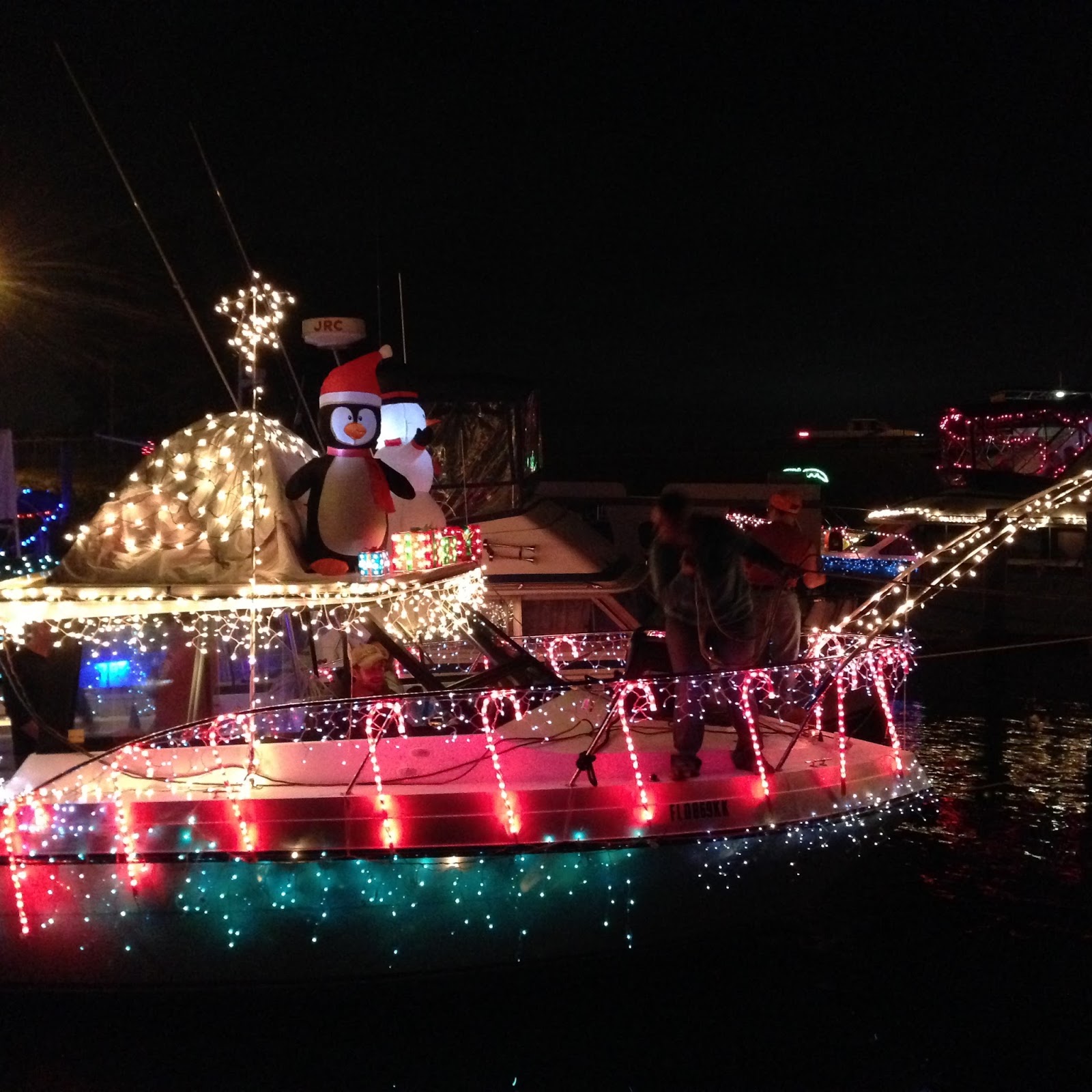
During my time at Tarpon Springs there was the annual Christmas Boat Parade, the boat in the next slip won second prize:


Old pulley with the hub inserted but is still broke

Remanufactured pulley with new hub welded and bored out, aligned to the "V" groove and trued up.


This portion of the Great Loop was reported to be the most challanging as there would be an overnight trip required by the slow boats (Trawlers) and the disance traveled would be anywhers from 160-180 miles depending on the choosen start and finish.
We started off at 9:30 AM with 3 boats. The early start was to allow the slower boats an arrival at 10 AM the next day. Arrival before that time would be hampered by direct sunlight reflecting off the water and making the crab bouys difficult to see. (Joe's note: these crab pots were made out to be horrendous, however they do not compare to the challenges of the Maine lobster bouys.)
The cruise progresed satisfactorily until about 2 AM in the morning, my engine over heat alarm sounded and I had to shut down my engine. I called for assistance and went to the negine room to assess the problem. Unfortunately the problem turned out to be a broken raw water pulley which could not be repaired by me and I was to discover later by only a qualified machine shop. Surveyor One and Panda Bear responded to my alarm and it was decided to have Panda bear take me in tow until we could reach within 25 miles and U.S Boat Tow service. So from 2 AM until 9 AM Panda Bear towed Firebird until relieved by U.S.Boat .
U.S.Boat Tow pushed me into a slip aranged by the Harbor Host: Herb Seaton. There I would sit while I tried to find a replacement pulley and eventually ending up getting my pulley remanufactured.
During my time at Tarpon Springs there was the annual Christmas Boat Parade, the boat in the next slip won second prize:


Old pulley with the hub inserted but is still broke


Tarpon Springs FL to Dunedin: Cruising Time: 2.5 hrs (10 Dec)
After successfully reinstalling my remanufactured pulley I decided to move Firebird to Dunedin "Marker One" Marina as their prices were more favorable and would allow me to long term keep the boat there so I could return home for Christmas. The Harbor Host (Herb Seaton) accompanied me thru the shallow channels and to Dunedin, providing local knowledge along the way. His help following the pulley debacle was immeasurable.
Christmas came and went, I flew home celebrated the holidays with family and then drove my car back to Dunedin. Back in Tarpon Springs they were celebrating Epiphany in the Greek tradition. After church observances there was a parade to the near by lagoon where the Bishop would throw a cross into the water and a groupe of boys would dive to retrieve. The winner would get atrophy and a years blessings form the church.The following pictures were taken by a fellow boater (Flora of "Pand Bear") and provided to me as a favor.She was closer and had a good lens/camera to get great shots.
 First the boys would jump into the water and swim to a row boat where they would await the cross toss. Note that one of the boats is sunk, several boys tried to board the boat from the stern at the same time and the sunk it. Those boys had to swim to another, a local observer said that usually one boat a year is sunk in the same fashion.


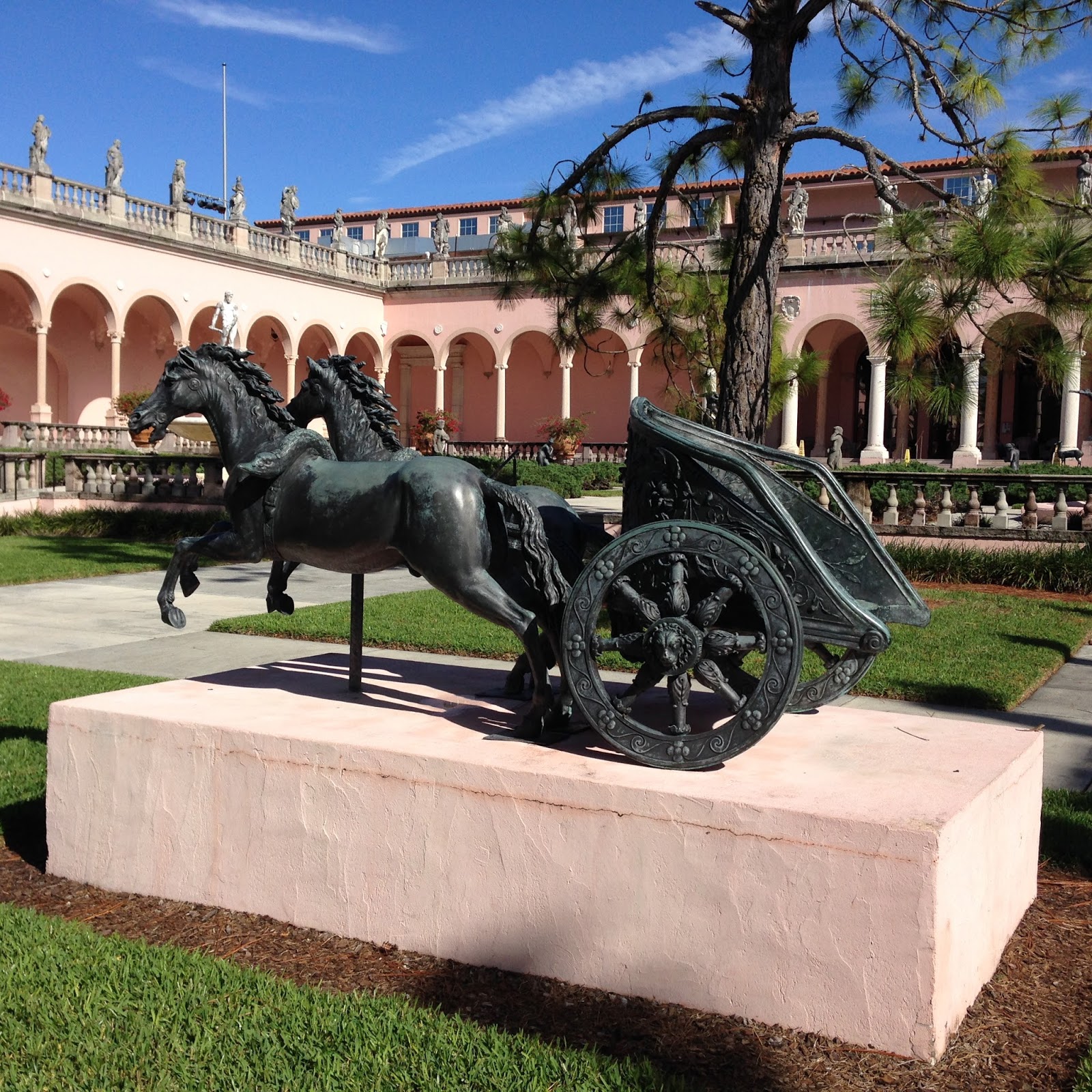
Now that I had my car I decided to drive to Sarasota with a friend (Sid)from the boat "Something Special"to visit the Ringling Estate and museum. The next few pictures are from the trip. The first series are from the circus portion, wagons and costumes.


The grounds and gardens of this estate are spectacular, with statuaries all over the area:


 This is the Grave site for the Ringlings. John died in 1936 and his wife Mable in 1929.

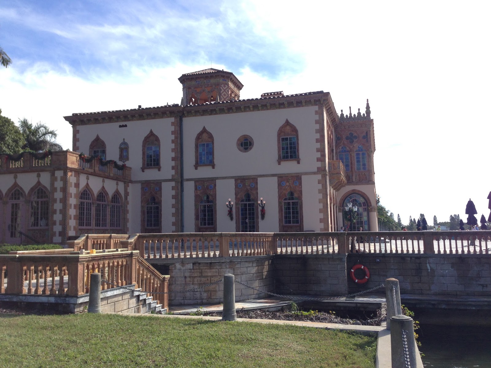
In addition to the circus museum buildings there are the Ringling home "Ca' d' Zan" and a museam of art. These photos are of "Ca' d' Zan" (meaning house of John in Venetian dialect) which cost 1.5 million dollars to build in today's figures about $20.9 million.
Front views:


Side view of the house.

 View of the side of the house facing the ocean to the west.
 The dock side of the estate:

 Interior photo of the great room


The Museam of Art was also built in the Venetian style with large courtyard and gardens. The majority of art on display were of the Baroque era, although beautiful to some and priceless, I am not a fan of that painting style. These pictures are of the interior court, statuary and building architecture.


Dunedin to Gulfport FL: Cruising Time: 4.5 hrs (11 Jan 2016)
Gulfport to Sarasota FL: Cruising Time: 6 hrs (12 Jan)
The stop in Sarasota was extended for a few days due weather. So I got wo roam the city and go to some great restaurants.
Entrance to Captain Jack's Marina:


Taken from the Look Magazine photo of the famous kiss in Times Square. Statue is about 20 ft tall.


Sarasota to Fishermans Wharf, Venice FL: Cruising Time: 5 hrs (15 Jan)
Stayed here 2 days as the winds were punishing reaching Gale force at times. Back in Sarasota there was a tornado which killed 2 unfortunate people. The town looks like a lot of others in Florida. I didn't find anything to photo.
Venice to Cabbage Key FL: Cruising Time: 6 hrs (18 Jan)


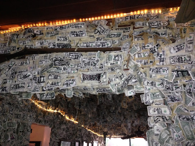
 The Cabbage Key restaurant is covered on all walls and ceiling with dollar bills which visitors add with their name or some comment. The restaurant takes some of them down after a year and donate to charity. I'm told that they average $6000 in donations per year.

Cabbage Key to Cape Coral FL: Cruising Time: 4.3 hrs (19 Jan)
Cape Coral to Fort Myers FL: Cruising Time: 2 hrs (20 Jan)
The waterfront and river walk way as well as some downtown pictures. The Fort Myers Yacht Basin is in the center of Ft Myers waterfront and just 1 block to the center. There are many restaurants and interesting things to see and do. I was able to catch a musical review at the Repertoire Theater just across the street.
 Legacy Marina, another favorite stop for Great Loopers.


Christmas came and went, I flew home celebrated the holidays with family and then drove my car back to Dunedin. Back in Tarpon Springs they were celebrating Epiphany in the Greek tradition. After church observances there was a parade to the near by lagoon where the Bishop would throw a cross into the water and a groupe of boys would dive to retrieve. The winner would get atrophy and a years blessings form the church.The following pictures were taken by a fellow boater (Flora of "Pand Bear") and provided to me as a favor.She was closer and had a good lens/camera to get great shots.


Now that I had my car I decided to drive to Sarasota with a friend (Sid)from the boat "Something Special"to visit the Ringling Estate and museum. The next few pictures are from the trip. The first series are from the circus portion, wagons and costumes.


The grounds and gardens of this estate are spectacular, with statuaries all over the area:


In addition to the circus museum buildings there are the Ringling home "Ca' d' Zan" and a museam of art. These photos are of "Ca' d' Zan" (meaning house of John in Venetian dialect) which cost 1.5 million dollars to build in today's figures about $20.9 million.
Front views:


Dunedin to Gulfport FL: Cruising Time: 4.5 hrs (11 Jan 2016)
Gulfport to Sarasota FL: Cruising Time: 6 hrs (12 Jan)
The stop in Sarasota was extended for a few days due weather. So I got wo roam the city and go to some great restaurants.
Entrance to Captain Jack's Marina:

I spent 2 nights off shore, 1 night on the hook and one on the mooring before moving into shore to a slip.


Sarasota to Fishermans Wharf, Venice FL: Cruising Time: 5 hrs (15 Jan)
Stayed here 2 days as the winds were punishing reaching Gale force at times. Back in Sarasota there was a tornado which killed 2 unfortunate people. The town looks like a lot of others in Florida. I didn't find anything to photo.
Venice to Cabbage Key FL: Cruising Time: 6 hrs (18 Jan)

Cabbage Ket had added a fence around the Tortoise burrows to keep people away and allow the tortoise some privacy. I am told that all the residence toroise are named after the Ninjia Turtles.


Cabbage Key to Cape Coral FL: Cruising Time: 4.3 hrs (19 Jan)
Cape Coral to Fort Myers FL: Cruising Time: 2 hrs (20 Jan)
The waterfront and river walk way as well as some downtown pictures. The Fort Myers Yacht Basin is in the center of Ft Myers waterfront and just 1 block to the center. There are many restaurants and interesting things to see and do. I was able to catch a musical review at the Repertoire Theater just across the street.


The next several pictures are the works of Edgardo Carmona which were promptly displayed around the city. The are here from Jan thru March. The Chamber of Commerce provided maps of the city and the sculptures.
Cadencia

Trialogo


Territorio

Negacion a Baco

Juego de Ajedrez

Al Filo

Al Galope

Juego de Ajedrez


El vendedor de raspao

Vendedora de frutas

Faena en la plaza


The Ford Edison estate is a long walk from the marina or a short Trolly ride and houses the winter homes of Thomas Edison and his neighbor Henry Ford. Edison used this location to find a suitable substitute plant for latex used in making rubber.The need was established during WW1 when the source of rubber was deemed a strategic material and transporting from the tropics to USA was a logistical problem.
Thomas Edison


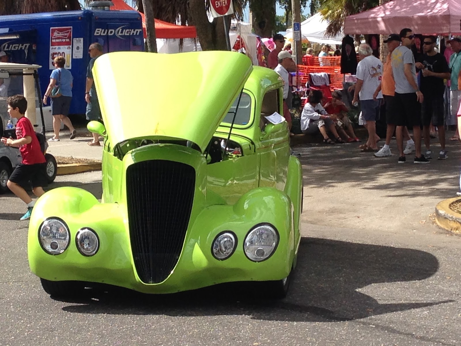


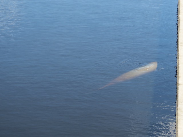


FT Myers; Jet Blue Park and Red Sox spring training:


Batter up: "Big Pappy"

PoP up!